MyTopo
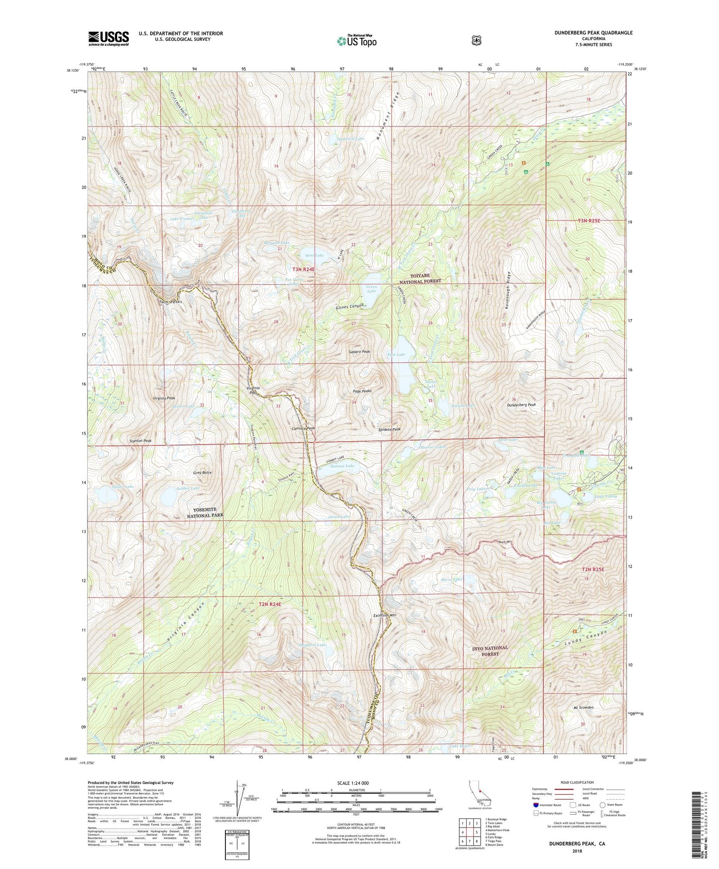
Dunderberg Peak California US Topo Map
Couldn't load pickup availability
Also explore the Dunderberg Peak Forest Service Topo of this same quad for updated USFS data
2021 topographic map quadrangle Dunderberg Peak in the state of California. Scale: 1:24000. Based on the newly updated USGS 7.5' US Topo map series, this map is in the following counties: Mono, Tuolumne. The map contains contour data, water features, and other items you are used to seeing on USGS maps, but also has updated roads and other features. This is the next generation of topographic maps. Printed on high-quality waterproof paper with UV fade-resistant inks.
Quads adjacent to this one:
West: Matterhorn Peak
Northwest: Buckeye Ridge
North: Twin Lakes
Northeast: Big Alkali
East: Lundy
Southeast: Mount Dana
South: Tioga Pass
Southwest: Falls Ridge
This map covers the same area as the classic USGS quad with code o38119a3.
Contains the following named places: Bergona Lake, Big Valley Lake, Black Mountain, Blue Lake, Burro Lake, Camiaca Peak, Cooney Lake, Crater Crest, Dunderberg Mill, Dunderberg Peak, East Fork Green Creek, East Lake, Epidote Peak, Excelsior Mountain, Frog Lakes, Gabbro Peak, Gilman Lake, Glenberry Lake, Glines Canyon, Green Creek Campground, Green Creek Summer Home Area, Green Lake, Grey Butte, Hoover Lakes, Hunewill Lake, Kavanaugh Ridge, Lake Frances, Lake Helen, Little Valley, Lundy Canyon Trailhead, May Lundy Mine, Moat Lake, Monument Ridge, Mount Scowden, Nutter Lake, Onion Lake, Page Peaks, Par Value Lakes, Red Lake, Return Lake, Shepherd Crest, Shepherd Lake, Soldier Lake, Spiller Lake, Stanton Peak, Summit Lake, Trumbull Campground, Trumbull Lake, Trumbull Lake Campground, Turquoise Lake, Twin Peaks, Virginia Lakes, Virginia Lakes Census Designated Place, Virginia Lakes Resort, Virginia Pass, Virginia Peak, West Fork Green Creek, West Lake