MyTopo
Matterhorn Peak California US Topo Map
Couldn't load pickup availability
Also explore the Matterhorn Peak Forest Service Topo of this same quad for updated USFS data
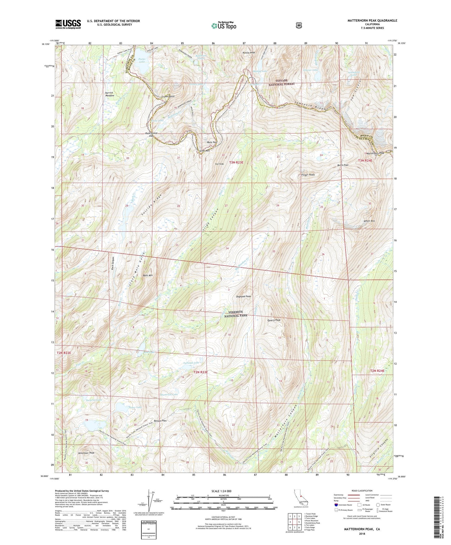
2021 topographic map quadrangle Matterhorn Peak in the state of California. Scale: 1:24000. Based on the newly updated USGS 7.5' US Topo map series, this map is in the following counties: Tuolumne, Mono. The map contains contour data, water features, and other items you are used to seeing on USGS maps, but also has updated roads and other features. This is the next generation of topographic maps. Printed on high-quality waterproof paper with UV fade-resistant inks.
Quads adjacent to this one:
West: Piute Mountain
Northwest: Tower Peak
North: Buckeye Ridge
Northeast: Twin Lakes
East: Dunderberg Peak
Southeast: Tioga Pass
South: Falls Ridge
Southwest: Ten Lakes
This map covers the same area as the classic USGS quad with code o38119a4.
Contains the following named places: Avalanche Lake, Bath Mountain, Benson Pass, Big Meadow Creek, Burro Pass, Camp Creek, Crazy Mule Gulch, Crown Lake, Crown Point, Doe Lake, Doghead Peak, Finger Peaks, Glacier Lake, Ice Lake, Kerrick Meadow, Kettle Peak, Maltby Lake, Matterhorn Peak, McCabe Creek, Mule Pass, Peeler Lake, Quarry Peak, Robinson Lakes, Rock Canyon, Rock Creek, Rock Island Lake, Rock Island Pass, Sawtooth Ridge, Shamrock Lake, Sister Lake, Slide Canyon, Slide Mountain, Smedberg Lake, Snow Lake, Suicide Ridge, Surprise Lake, Tallulah Lake, The Cleaver, The Slide, Volunteer Peak, Whorl Mountain, Wilson Creek