MyTopo
Vogelsang Peak California US Topo Map
Couldn't load pickup availability
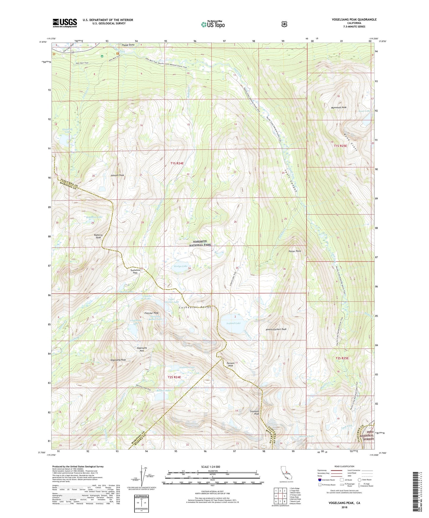
2021 topographic map quadrangle Vogelsang Peak in the state of California. Scale: 1:24000. Based on the newly updated USGS 7.5' US Topo map series, this map is in the following counties: Tuolumne, Mariposa, Madera, Mono. The map contains contour data, water features, and other items you are used to seeing on USGS maps, but also has updated roads and other features. This is the next generation of topographic maps. Printed on high-quality waterproof paper with UV fade-resistant inks.
Quads adjacent to this one:
West: Tenaya Lake
Northwest: Falls Ridge
North: Tioga Pass
Northeast: Mount Dana
East: Koip Peak
Southeast: Mount Ritter
South: Mount Lyell
Southwest: Merced Peak
This map covers the same area as the classic USGS quad with code o37119g3.
Contains the following named places: Amelia Earhart Peak, Bernice Lake, Boothe Lake, Cathedral Range, Elizabeth Lake, Evelyn Lake, Fletcher Lake, Fletcher Peak, Florence Creek, Gallison Lake, Hanging Basket Lake, Ireland Creek, Ireland Lake, Johnson Peak, Kuna Creek, Kuna Lake, Lyell Canyon, Maclure Creek, Maclure Lake, Mammoth Peak, Parsons Peak, Potter Point, Rafferty Creek, Rafferty Peak, Reymann Lake, Simmons Peak, Townsley Lake, Tuolumne Meadows Campground, Tuolumne Pass, Unicorn Creek, Upper Fletcher Lake, Vogelsang High Sierra Camp, Vogelsang Lake, Vogelsang Pass, Vogelsang Peak