MyTopo
Feliciana Mountain California US Topo Map
Couldn't load pickup availability
Also explore the Feliciana Mountain Forest Service Topo of this same quad for updated USFS data
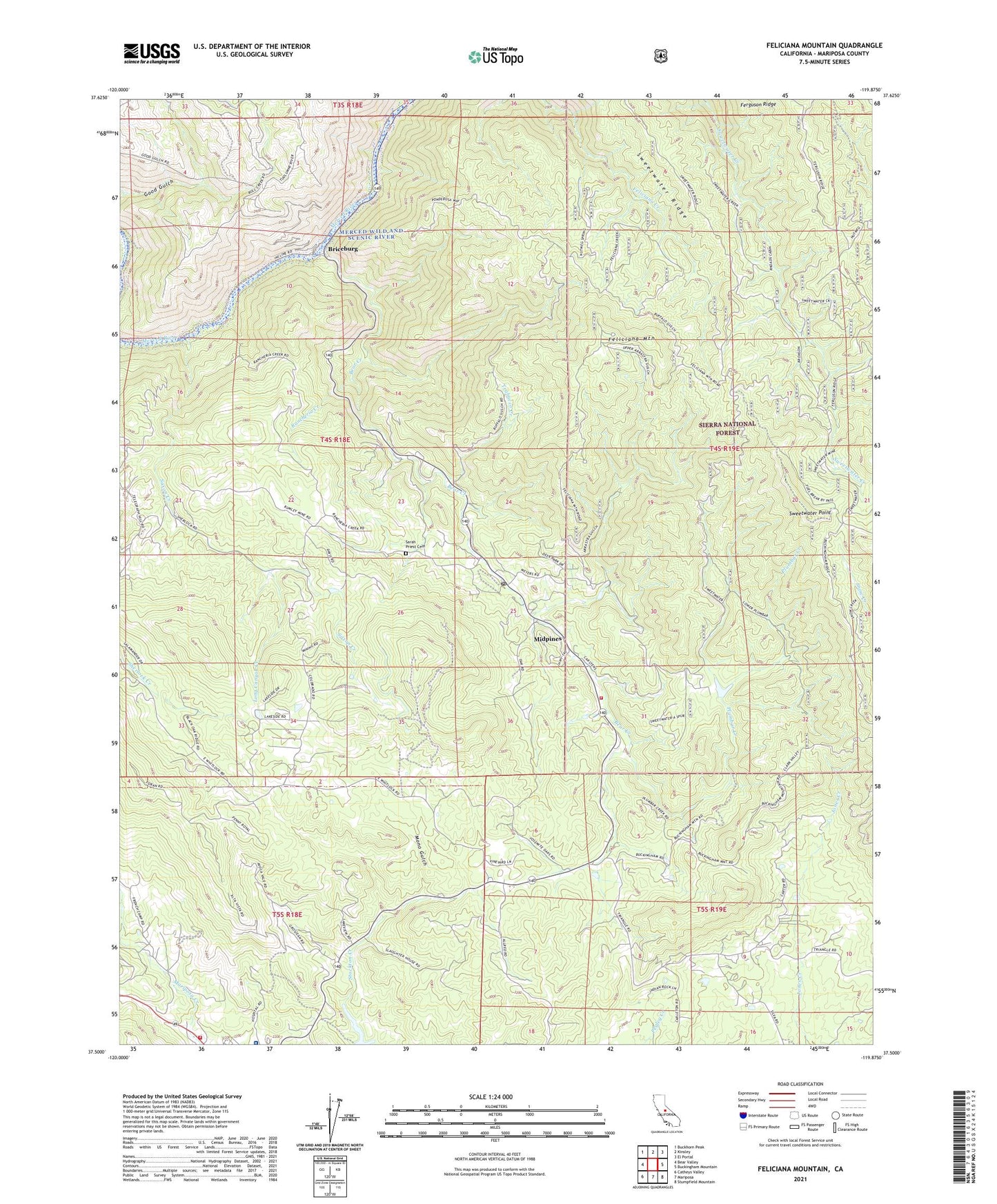
2021 topographic map quadrangle Feliciana Mountain in the state of California. Scale: 1:24000. Based on the newly updated USGS 7.5' US Topo map series, this map is in the following counties: Mariposa. The map contains contour data, water features, and other items you are used to seeing on USGS maps, but also has updated roads and other features. This is the next generation of topographic maps. Printed on high-quality waterproof paper with UV fade-resistant inks.
Quads adjacent to this one:
West: Bear Valley
Northwest: Buckhorn Peak
North: Kinsley
Northeast: El Portal
East: Buckingham Mountain
Southeast: Stumpfield Mountain
South: Mariposa
Southwest: Catheys Valley
This map covers the same area as the classic USGS quad with code o37119e8.
Contains the following named places: Acorn Lodge, Bear Creek School, Briceburg, Buffalo Mine, California Dept Forestry and Fire Protection Madera - Mariposa - Merced Unit Mariposa Fire Station, Colorado Mine, Colorado School, Feliciana Mine, Feliciana Mountain, John C Fremont Hospital, King Solomon Mine, Long Canyon Creek, Mariposa County, Mariposa County Fire Department Company 21 Midpines, Mariposa Ranger Station, Midpines, Midpines Census Designated Place, Midpines Park, Midpines Post Office, Mono Camp, Mono Gulch, Plumbar Creek, Rancheria Creek, Sarah Priest Cemetery, Saxon Creek, Schroeder Mine, Sierra Faith Center, Summit Inn, Sweetwater Mine, Sweetwater Point, Sweetwater Ridge, Timber Lodge, Trabucco Creek, ZIP Codes: 95338, 95345