MyTopo
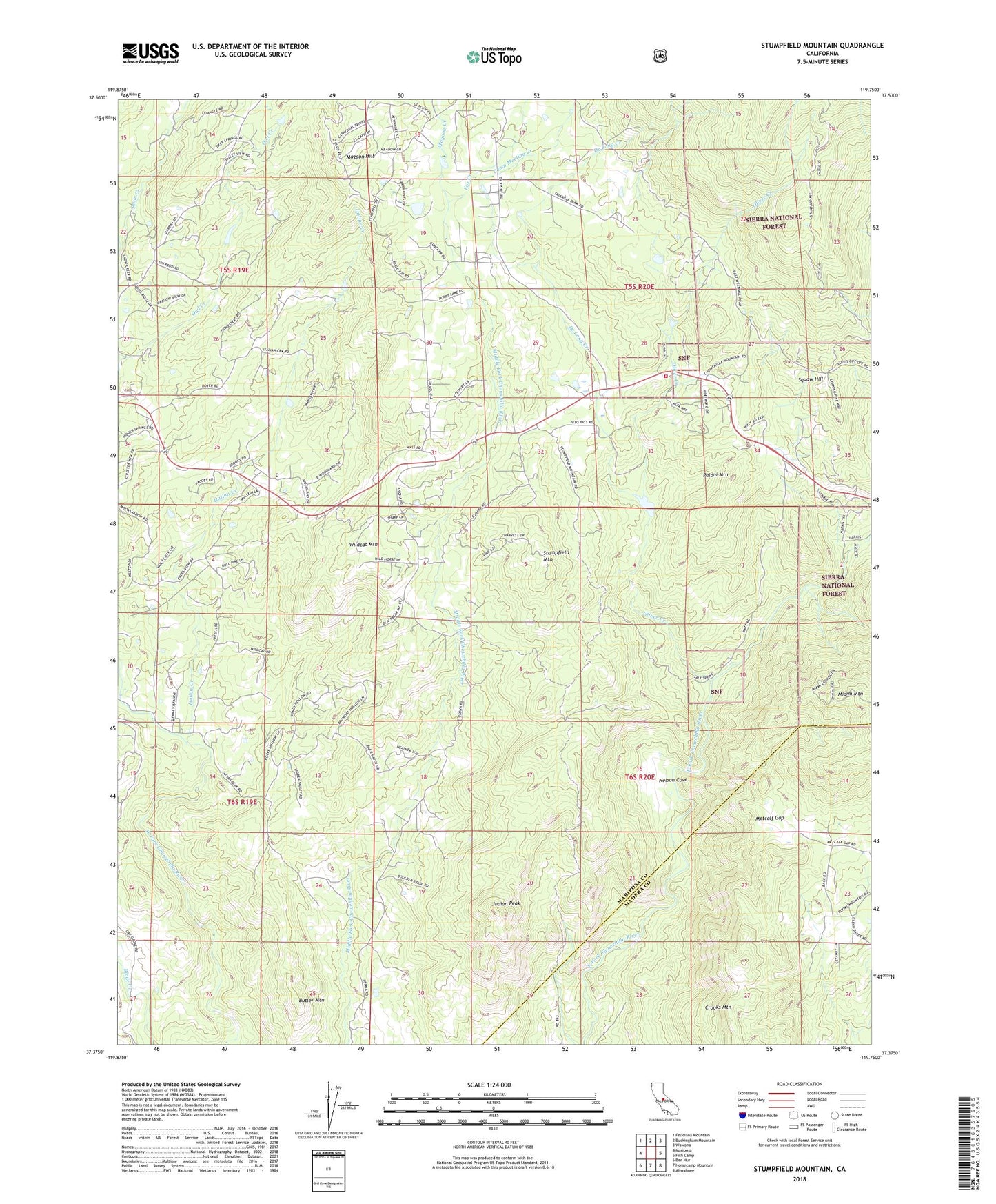
Stumpfield Mountain California US Topo Map
Couldn't load pickup availability
Also explore the Stumpfield Mountain Forest Service Topo of this same quad for updated USFS data
2023 topographic map quadrangle Stumpfield Mountain in the state of California. Scale: 1:24000. Based on the newly updated USGS 7.5' US Topo map series, this map is in the following counties: Mariposa, Madera. The map contains contour data, water features, and other items you are used to seeing on USGS maps, but also has updated roads and other features. This is the next generation of topographic maps. Printed on high-quality waterproof paper with UV fade-resistant inks.
Quads adjacent to this one:
West: Mariposa
Northwest: Feliciana Mountain
North: Buckingham Mountain
Northeast: Wawona
East: Fish Camp
Southeast: Ahwahnee
South: Horsecamp Mountain
Southwest: Ben Hur
This map covers the same area as the classic USGS quad with code o37119d7.
Contains the following named places: Butler Mountain, Camp Meeting Creek, Chowchilla School, De Long Creek, Department of Forestry and Fire Protection Usona Fire Station, Elliott Corner, Fox Creek, Hillside Baptist Church, Indian Peak, Indian Peak School, Italian Creek, Jones Creek, Magoon Creek, Magoon Hill, Metcalf Gap, Nelson Cove, Oliver Creek, Paloni Mountain, Snow Creek, Squaw Hill, Stumpfield Mountain, Usona Fire Station, Wildcat Mountain