
MyTopo
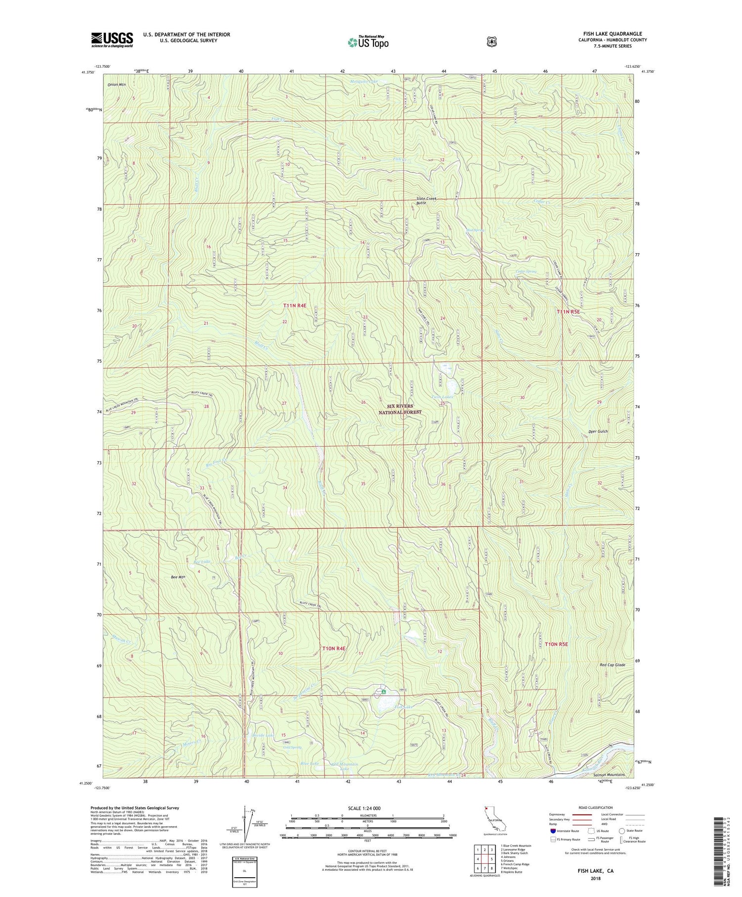
Fish Lake California US Topo Map
Couldn't load pickup availability
Also explore the Fish Lake Forest Service Topo of this same quad for updated USFS data
2022 topographic map quadrangle Fish Lake in the state of California. Scale: 1:24000. Based on the newly updated USGS 7.5' US Topo map series, this map is in the following counties: Humboldt. The map contains contour data, water features, and other items you are used to seeing on USGS maps, but also has updated roads and other features. This is the next generation of topographic maps. Printed on high-quality waterproof paper with UV fade-resistant inks.
Quads adjacent to this one:
West: Johnsons
Northwest: Blue Creek Mountain
North: Lonesome Ridge
Northeast: Bark Shanty Gulch
East: Orleans
Southeast: Hopkins Butte
South: Weitchpec
Southwest: French Camp Ridge
This map covers the same area as the classic USGS quad with code o41123c6.
Contains the following named places: Bee Creek, Bee Lake, Bee Mountain, Big Foot Creek, Blue Lake, Cedar Camp, Cedar Spring, Cold Spring, Divide Lake, Dyer Gulch, Fish Creek, Fish Lake, Fish Lake Recreation Site, Garnit Ranch, Mosquito Lake, Mud Spring, Onion Mountain, Red Cap Glade, Red Mountain Lake, Rock Prairie, Serpentine Creek, Slate Creek, Slate Creek Butte, Twin Lakes, Wright Place


