MyTopo
Weitchpec California US Topo Map
Couldn't load pickup availability
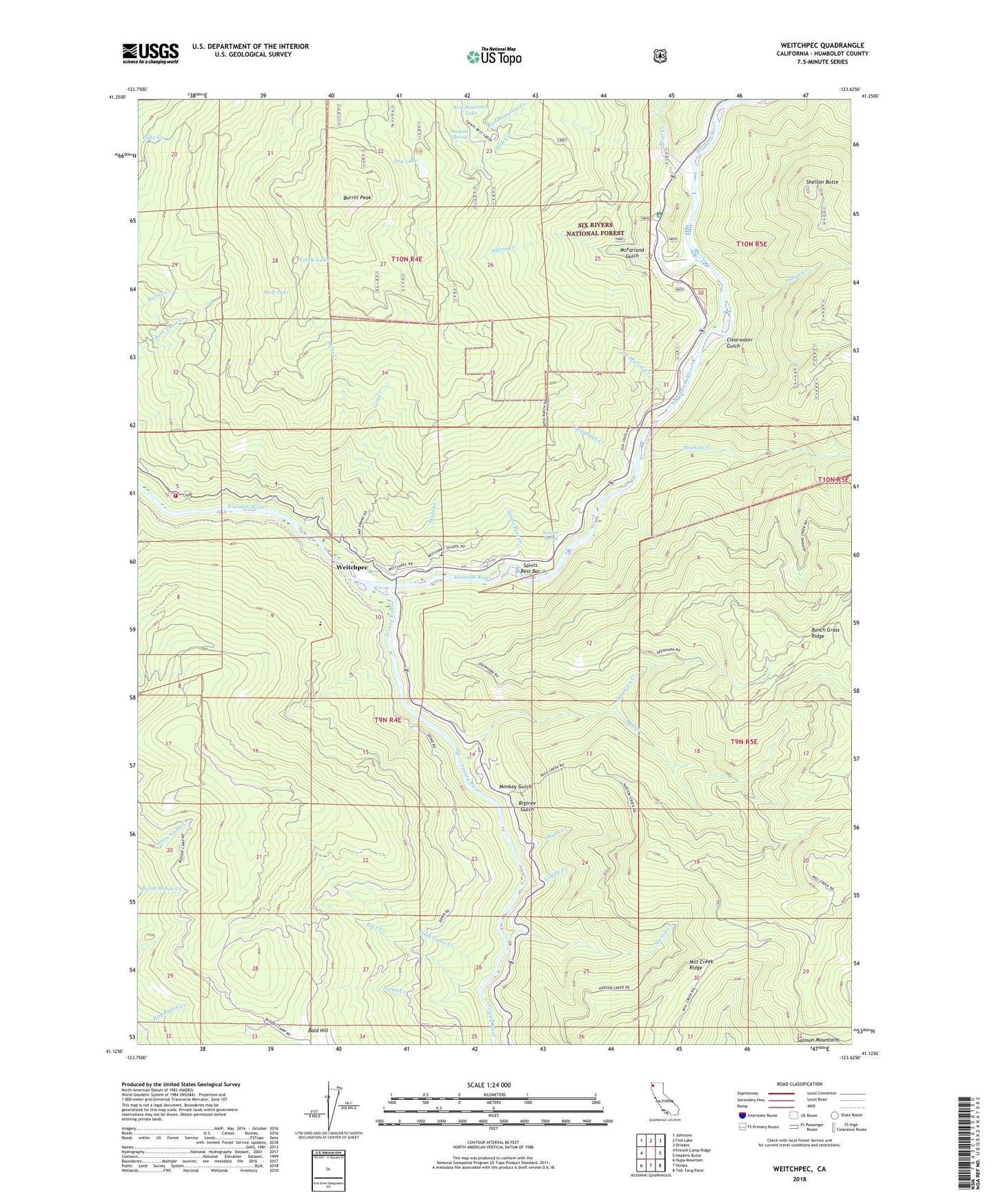
2022 topographic map quadrangle Weitchpec in the state of California. Scale: 1:24000. Based on the newly updated USGS 7.5' US Topo map series, this map is in the following counties: Humboldt. The map contains contour data, water features, and other items you are used to seeing on USGS maps, but also has updated roads and other features. This is the next generation of topographic maps. Printed on high-quality waterproof paper with UV fade-resistant inks.
Quads adjacent to this one:
West: French Camp Ridge
Northwest: Johnsons
North: Fish Lake
Northeast: Orleans
East: Hopkins Butte
Southeast: Tish Tang Point
South: Hoopa
Southwest: Hupa Mountain
This map covers the same area as the classic USGS quad with code o41123b6.
Contains the following named places: Aikens Creek, Aikens Creek Campground, Bald Hill, Bens Creek, Big Creek, Bigtree Gulch, Bloody Camp, Bluff Creek, Bluff Creek Campground, Bluff Creek Forest Service Facility, Bluff Creek Guard Station, Bull Creek, Burrill Peak, Butte Camp, Cacanaugh Creek, Clearwater Gulch, Cooper Ranch, Coyote Creek, Deerhorn Camp, Deerhorn Creek, Dragsaw Spring, Dry Lake, Dunn Prairie, Ertlerger, Essenpries Mill, Fern Prairie, Gist Creek, Grasshopper Prairie, Half Lake, Hopkins Creek, Indian Creek, Joe Marine Creek, Lake Prairir, Limb Camp Creek, McFarland Gulch, Monkey Gulch, Muddy Creek, Nixon Creek, Norton Creek, Pekwuteu, Pumpkin Camp, Red Mountain Creek, Saints Rest Bar, Saints Rest Creek, Shelton Butte, Shelton Butte Lookout, Skunk Creek, Slide Creek, Sulphur Spring, Trinity River, Turtle Lake, Waseck, Weitchpec, Weitchpec Census Designated Place, Weitchpec Creek, Weitchpec Elementary School, Willow Creek-Hoopa Valley Division, Youngs Lake, Yurok Volunteer Fire Department Station 1