
MyTopo
Johnsons California US Topo Map
Couldn't load pickup availability
Also explore the Johnsons Forest Service Topo of this same quad for updated USFS data
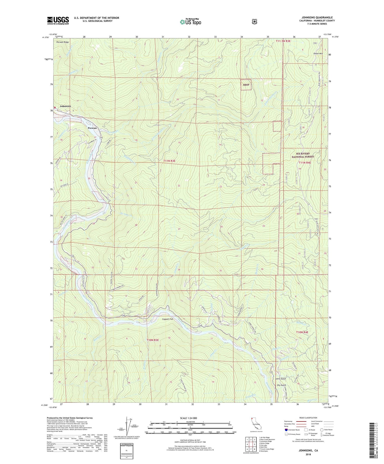
2022 topographic map quadrangle Johnsons in the state of California. Scale: 1:24000. Based on the newly updated USGS 7.5' US Topo map series, this map is in the following counties: Humboldt. The map contains contour data, water features, and other items you are used to seeing on USGS maps, but also has updated roads and other features. This is the next generation of topographic maps. Printed on high-quality waterproof paper with UV fade-resistant inks.
Quads adjacent to this one:
West: Holter Ridge
Northwest: Ah Pah Ridge
North: Blue Creek Mountain
Northeast: Lonesome Ridge
East: Fish Lake
Southeast: Weitchpec
South: French Camp Ridge
Southwest: Bald Hills
This map covers the same area as the classic USGS quad with code o41123c7.
Contains the following named places: Cappell Creek, Cappell Flat, China Creek, Chqui Creek, Clirliah Creek, Coon Creek, Devil Creek, Dry Gulch, East Fork Pecwan Creek, Ha Amar Creek, Jack Norton Elementary School, Johnson Creek, Johnsons, Kep'el Census Designated Place, Knulthkarn Creek, Lewis Gulch, Mareep Creek, Mawah Creek, Mettah, Mettah Creek, Moore Ranch, Morek Creek, Morek School, Nacko Creek, Notchko, Pecwan, Pecwan Creek, Pecwan District, Pecwan Union School, Pekwan, Racehorse Prairie, Roach Creek, Shregegon, Surgone, Waukell Creek, Wautec Census Designated Place, West Fork Pecwan Creek, Yoruk Volunteer Fire Department Station 2


