MyTopo
Flournoy California US Topo Map
Couldn't load pickup availability
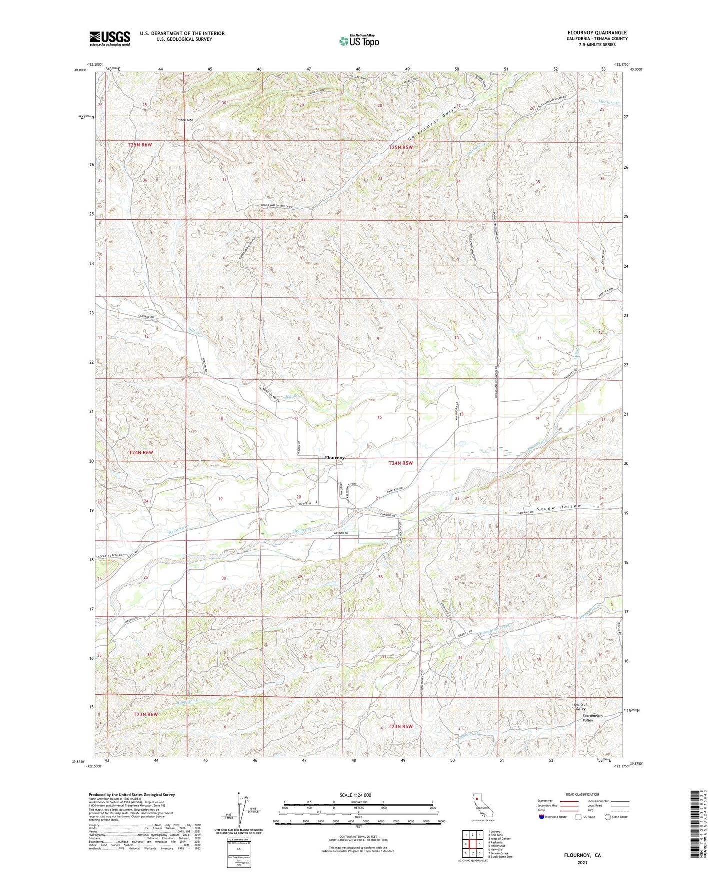
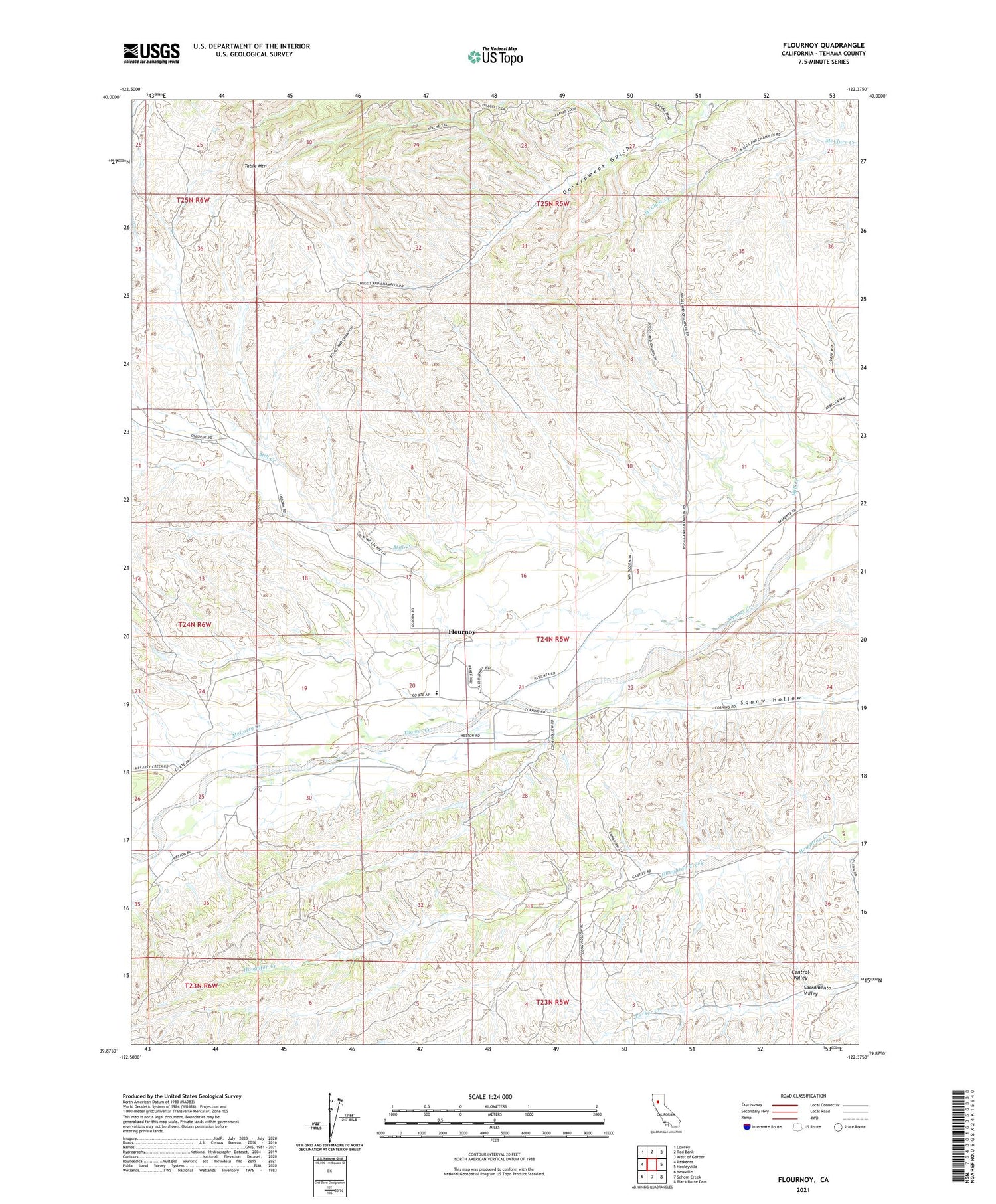
2023 topographic map quadrangle Flournoy in the state of California. Scale: 1:24000. Based on the newly updated USGS 7.5' US Topo map series, this map is in the following counties: Tehama. The map contains contour data, water features, and other items you are used to seeing on USGS maps, but also has updated roads and other features. This is the next generation of topographic maps. Printed on high-quality waterproof paper with UV fade-resistant inks.
Quads adjacent to this one:
West: Paskenta
Northwest: Lowrey
North: Red Bank
Northeast: West of Gerber
East: Henleyville
Southeast: Black Butte Dam
South: Sehorn Creek
Southwest: Newville
This map covers the same area as the classic USGS quad with code o39122h4.
Contains the following named places: Flournoy, Flournoy Census Designated Place, Fluornoy Elementary School, McCarty Creek, Nome Lackee Indian Reservation Monument, Table Mountain, ZIP Code: 96029