MyTopo
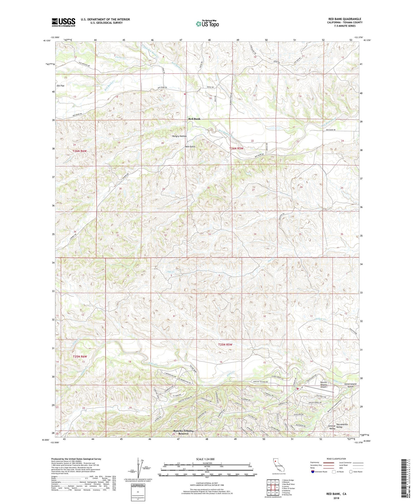
Red Bank California US Topo Map
Couldn't load pickup availability
2022 topographic map quadrangle Red Bank in the state of California. Scale: 1:24000. Based on the newly updated USGS 7.5' US Topo map series, this map is in the following counties: Tehama. The map contains contour data, water features, and other items you are used to seeing on USGS maps, but also has updated roads and other features. This is the next generation of topographic maps. Printed on high-quality waterproof paper with UV fade-resistant inks.
Quads adjacent to this one:
West: Lowrey
Northwest: Oxbow Bridge
North: Blossom
Northeast: Red Bluff West
East: West of Gerber
Southeast: Henleyville
South: Flournoy
Southwest: Paskenta
This map covers the same area as the classic USGS quad with code o40122a4.
Contains the following named places: Clover Creek, Digger Creek, Government Gulch, Hungry Hollow, North Fork Red Bank Creek, Pigpen Creek, Rancho Tehama Airport, Rancho Tehama Reserve, Rancho Tehama Reserve Census Designated Place, Red Bank, Tehama County Fire Department Red Bank, Tehama County Fire Department Station 13 Rancho Tehama, Vale Gulch