MyTopo
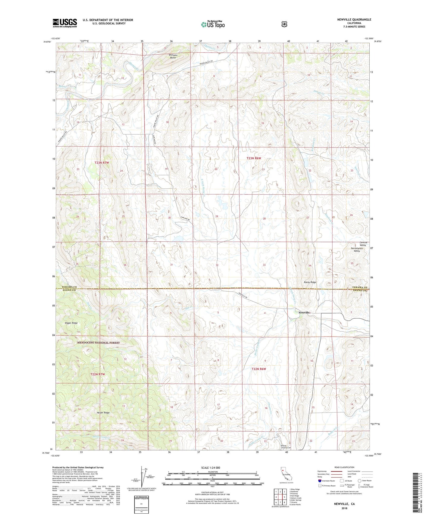
Newville California US Topo Map
Couldn't load pickup availability
Also explore the Newville Forest Service Topo of this same quad for updated USFS data
2022 topographic map quadrangle Newville in the state of California. Scale: 1:24000. Based on the newly updated USGS 7.5' US Topo map series, this map is in the following counties: Tehama, Glenn. The map contains contour data, water features, and other items you are used to seeing on USGS maps, but also has updated roads and other features. This is the next generation of topographic maps. Printed on high-quality waterproof paper with UV fade-resistant inks.
Quads adjacent to this one:
West: Hall Ridge
Northwest: Riley Ridge
North: Paskenta
Northeast: Flournoy
East: Sehorn Creek
Southeast: Julian Rocks
South: Chrome
Southwest: Alder Springs
This map covers the same area as the classic USGS quad with code o39122g5.
Contains the following named places: Bennett Creek, Burrows Gap, Chrome Creek, Corral 265 Dam, Freshwater Creek, Heifer Camp Creek, Mill Creek, Newville, Rye 265-002 Dam, Salt Creek, Williams Butte