MyTopo
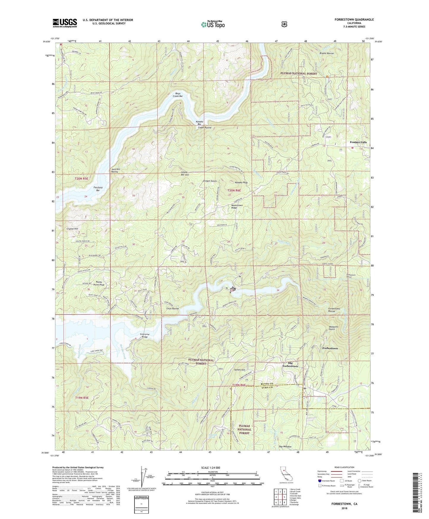
Forbestown California US Topo Map
Couldn't load pickup availability
Also explore the Forbestown Forest Service Topo of this same quad for updated USFS data
2022 topographic map quadrangle Forbestown in the state of California. Scale: 1:24000. Based on the newly updated USGS 7.5' US Topo map series, this map is in the following counties: Butte, Yuba. The map contains contour data, water features, and other items you are used to seeing on USGS maps, but also has updated roads and other features. This is the next generation of topographic maps. Printed on high-quality waterproof paper with UV fade-resistant inks.
Quads adjacent to this one:
West: Oroville Dam
Northwest: Berry Creek
North: Brush Creek
Northeast: Cascade
East: Clipper Mills
Southeast: Challenge
South: Rackerby
Southwest: Bangor
This map covers the same area as the classic USGS quad with code o39121e3.
Contains the following named places: Bean Creek, Bean Creek Bar, Bryant Ravine, Butte County Fire Department Station 52, Butte County Fire Department Station 61, Carlysle Mine, Cedar Ravine, Coon Ravine, Crystal Hill, Day Meadow, Denver Mine, Enterprise, Enterprise Bridge, Enterprise Rancheria, Fairfield Bar, Feather Falls, Feather Falls Census Designated Place, Feather Falls Elementary School, Forbestown, Forbestown Cemetery, Forbestown Census Designated Place, Forbestown Post Office, Forbestown Powerhouse, Forbestown Ravine, Forbestown Tunnel, Indian Cemetery, Island Bar Hill, Jack Hill Ravine, Kanaka Bar, Kanaka Creek, Kanaka Peak, Little Sucker Run, McCabe Creek, Midas Mine, Miners Ranch Canal, Mooretown Cemetery, Mooretown Ridge, Mosquito Gulch, Nutmeg Creek, Old Forbestown, Oroville Wyandotte Canal, Ponderosa Diversion Dam, Ponderosa Reservoir, Powell Creek, Roadside Spring, Rocky Point Peak, Southern Cross Mine, Sucker Run, Sunset Hill, ZIP Code: 95941