MyTopo
Oroville Dam California US Topo Map
Couldn't load pickup availability
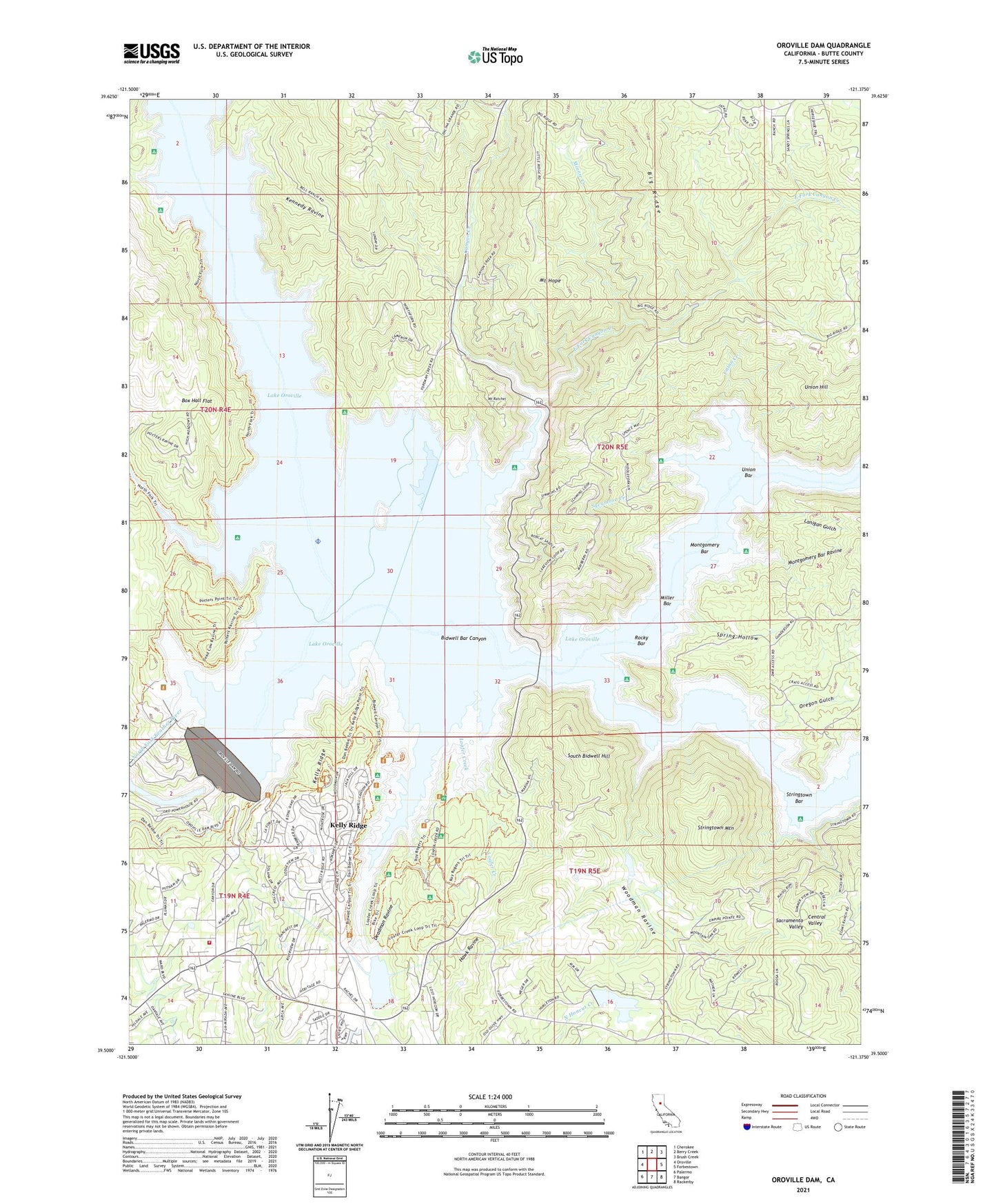
2021 topographic map quadrangle Oroville Dam in the state of California. Scale: 1:24000. Based on the newly updated USGS 7.5' US Topo map series, this map is in the following counties: Butte. The map contains contour data, water features, and other items you are used to seeing on USGS maps, but also has updated roads and other features. This is the next generation of topographic maps. Printed on high-quality waterproof paper with UV fade-resistant inks.
Quads adjacent to this one:
West: Oroville
Northwest: Cherokee
North: Berry Creek
Northeast: Brush Creek
East: Forbestown
Southeast: Rackerby
South: Bangor
Southwest: Palermo
This map covers the same area as the classic USGS quad with code o39121e4.
Contains the following named places: Atkins School, Bidwell, Bidwell Bar, Bidwell Bar Bridge, Bidwell Bar Canyon, Bidwell Bar Canyon Saddle Dam, Bidwell Canyon Campground, Bidwell Canyon Marina, Big Ridge, Bloomer, Bloomer Primitive Recreation Area, Box Hall Flat, Buffalo Ranch, Butte County Fire Department Station 64, Canyon Creek, Canyon Creek Bridge, Craig, Craig Recreation Area, Deadman Ravine, East Fork Canyon Creek, First Responder Emergency Medical Services Station 23, Foreman Creek, Foreman Creek Recreation Area, Harts Mill, Hawk Ravine, Jamison Ranch, Kelly Ridge, Kelly Ridge Census Designated Place, Kelly Ridge Fire Station, Kelly Ridge Golf Course, Kelly Ridge Recreation Area, Kelly Ridge Tunnel, Kennedy Ravine, Lake Oroville, Lake Oroville Landing Area Seaplane Base, Lake Oroville State Recreation Area, Lake Wyandotte, Lake Wyandotte 63 Dam, Land, Lanigan Gulch, Lave Oroville Visitors Center, Loafer Creek, Loafer Creek Campground, Loafer Creek Recreation Area, Miller Bar, Miners Ranch, Miners Ranch 63-009 Dam, Miners Ranch Reservoir, Miners Ranch Tunnel, Minnie Creek, Montgomery Bar, Montgomery Bar Ravine, Mount Hope, Mount Ratchel, Oregon Gulch, Oroville 1-048 Dam, Oroville Dam, Palermo Canal, Potter Ravine, Potters Ravine Recreation Area, Quartz, Rocky Bar, Schaefer Ranch, South Bidwell Hill, South Fork, Spillway Boat Ramp, Spring Hollow, Stringtown Bar, Stringtown Mountain, Sycamore Creek, Sycamore Creek Recreation Area, Union Bar, Union Creek, Union Hill, Woodman Ravine