MyTopo
Brush Creek California US Topo Map
Couldn't load pickup availability
Also explore the Brush Creek Forest Service Topo of this same quad for updated USFS data
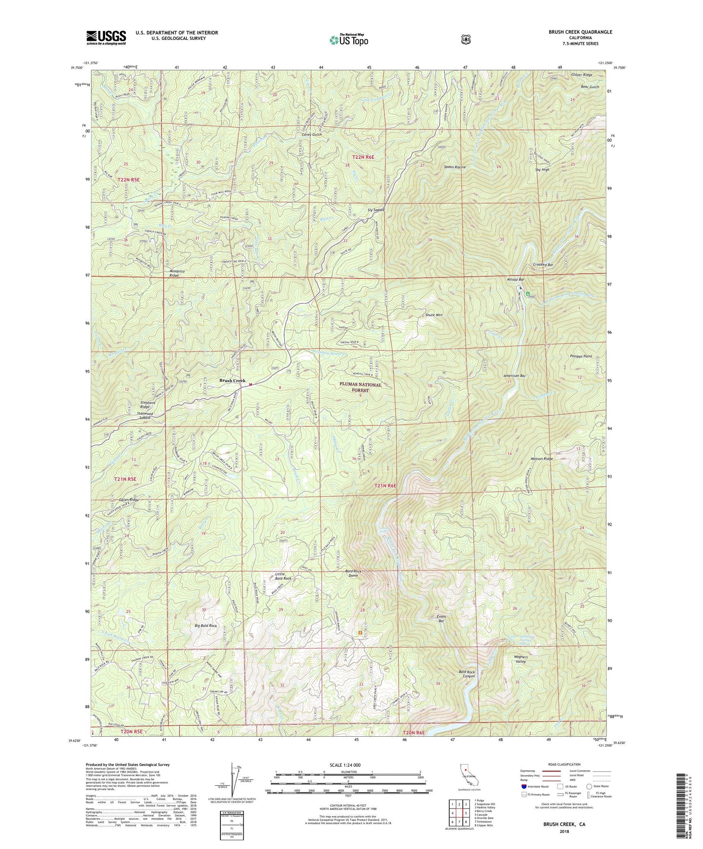
2022 topographic map quadrangle Brush Creek in the state of California. Scale: 1:24000. Based on the newly updated USGS 7.5' US Topo map series, this map is in the following counties: Butte, Plumas. The map contains contour data, water features, and other items you are used to seeing on USGS maps, but also has updated roads and other features. This is the next generation of topographic maps. Printed on high-quality waterproof paper with UV fade-resistant inks.
Quads adjacent to this one:
West: Berry Creek
Northwest: Pulga
North: Soapstone Hill
Northeast: Haskins Valley
East: Cascade
Southeast: Clipper Mills
South: Forbestown
Southwest: Oroville Dam
This map covers the same area as the classic USGS quad with code o39121f3.
Contains the following named places: Adams Creek, American Bar, Andy Smith Ranch, Bald Rock Canyon, Bald Rock Dome, Bear Gulch, Big Bald Rock, Big Bald Rock Trailhead, Big Bald Trail, Brush Creek, Brush Creek Administrative Site, Bush Creek, Butte County Fire Department Station 60, California Nutmeg Spring, Carey Gulch, Coon Creek, Crooked Bar, Curtain Falls, Dome Trail, Dome Trailhead, Evans Bar, Fall River, Feather Falls, Feather Falls Division, Frey Creek, Galen Ridge, Get Up and Get Creek, Grubbes Creek, Hinton Ranch, Horseshoe Mine, Indian Creek, Johnson Ranch, Junction House, Little Bald Rock, Little North Fork of Middle Fork Feather River, Little Ram Creek, Marble Creek, Middle Fork Feather River, Milsap Bar, Mishop Bar Campground, Mosquito Creek, Mosquito Ridge, Mountain House, Mountain House Creek, Mountain House Trail, Peavine Creek, Pompys Creek, Pompys Point, Ram Creek, Seater Ranch, Shute Mountain, Sky High, Sky High Trail, Sly Creek, Sly Saddle, South Branch Middle Fork Feather River, Spoon Ravine, Stanwood Saddle, Stephens Ridge, Tigus Creek, Turners Mill, Wagners Valley, Watson Cabin, Zink Ranch, ZIP Code: 95916