MyTopo
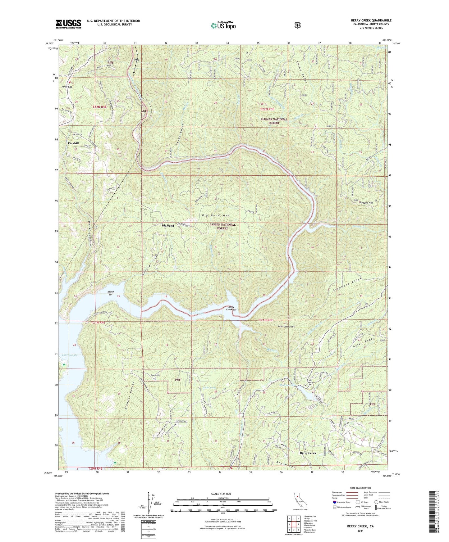
Berry Creek California US Topo Map
Couldn't load pickup availability
Also explore the Berry Creek Forest Service Topo of this same quad for updated USFS data
2021 topographic map quadrangle Berry Creek in the state of California. Scale: 1:24000. Based on the newly updated USGS 7.5' US Topo map series, this map is in the following counties: Butte. The map contains contour data, water features, and other items you are used to seeing on USGS maps, but also has updated roads and other features. This is the next generation of topographic maps. Printed on high-quality waterproof paper with UV fade-resistant inks.
Quads adjacent to this one:
West: Cherokee
Northwest: Paradise East
North: Pulga
Northeast: Soapstone Hill
East: Brush Creek
Southeast: Forbestown
South: Oroville Dam
Southwest: Oroville
This map covers the same area as the classic USGS quad with code o39121f4.
Contains the following named places: Berry Creek, Berry Creek Bar, Berry Creek Census Designated Place, Berry Creek Ditch, Berry Creek Elementary School, Berry Creek Station, Bidwell Creek, Big Bend, Big Bend Mine, Big Bend Mountain, Big Ripples, Blinzing, Bloomer Hill, Bloomer Ravine, Brush, Bunker Hill Mine, California Department of Forestry and Fire Protection Station 36 Jarbo Gap, California Department of Forestry and Fire Protection Station 62 Harts Mill, China Gulch, Chino Creek, Chino Ridge, Dark Canyon, David, Evening Star Mine, Frazier Creek, French Creek, Frenchmans Grave, Galen Creek, Goat Ranch Campground, Goat Ranch Recreation Area, Grizzly Creek, Hornet Mine, Hughes Place, Isaiah, Island Bar, Jack Creek, Jarbo Gap, Lake Madrone 1004 Dam, Lake Madrone Cemetery, Las Plumas, Last Chance Creek, Linden Spring, Madrone Lake, Martin Creek, Moseley, New Blinzing, Nolton Creek, North Fork Feather River, Parkhill, Pipers, Poe, Poe Powerhouse, Rock Creek, Rockefeller School, Rose Ranch, Rose School, Shields Gulch, South Fork Berry Creek, Stony Creek, Surcease Mine, Swayne Hill, Treasure Hill Mine, Tunnel Number Seven, Wild Yankee Creek, Wild Yankee Hill