
MyTopo
Scotia California US Topo Map
Couldn't load pickup availability
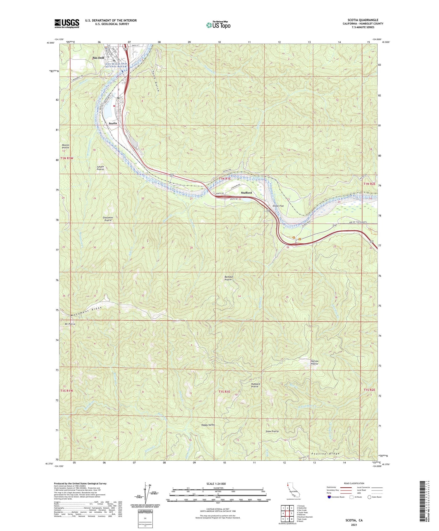
2021 topographic map quadrangle Scotia in the state of California. Scale: 1:24000. Based on the newly updated USGS 7.5' US Topo map series, this map is in the following counties: Humboldt. The map contains contour data, water features, and other items you are used to seeing on USGS maps, but also has updated roads and other features. This is the next generation of topographic maps. Printed on high-quality waterproof paper with UV fade-resistant inks.
Quads adjacent to this one:
West: Taylor Peak
Northwest: Fortuna
North: Hydesville
Northeast: Owl Creek
East: Redcrest
Southeast: Weott
South: Bull Creek
Southwest: Buckeye Mountain
This map covers the same area as the classic USGS quad with code o40124d1.
Contains the following named places: Barkdull Prairie, Brushy Creek, Dean Creek, Dinner Creek, Elinor, Elinor Flat, Elinor Junction, Fleisher Memorial Bridge, Giacomini Prairie, Greenlow Creek, Happy Valley, Harmonica Creek, Harrow Prairie, Hubbard Prairie, Jordan Creek, Juhaze Prairie, KEKA-FM (Eureka), Kiler Creek, Monument Creek, Monument Ridge, Mount Pierce, Murphy Memorial Bridge, Nelson Creek, Peavine Ridge, Pullen Creek, Rio Dell, Rio Dell Police Department, Rio Dell Post Office, Scotia, Scotia Census Designated Place, Scotia Log Pond 205 Dam, Scotia Post Office, Scotia Volunteer Fire Department, Snow Prairie, South Fork Bear Creek, Stafford, Stanwood A Murphy Elementary School, Stitz Creek, Tank Gulch, Turner Opening, Twin Creek, West Fork Bear Creek, ZIP Codes: 95562, 95565


