MyTopo
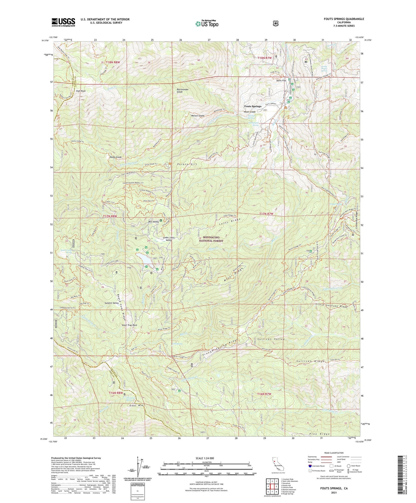
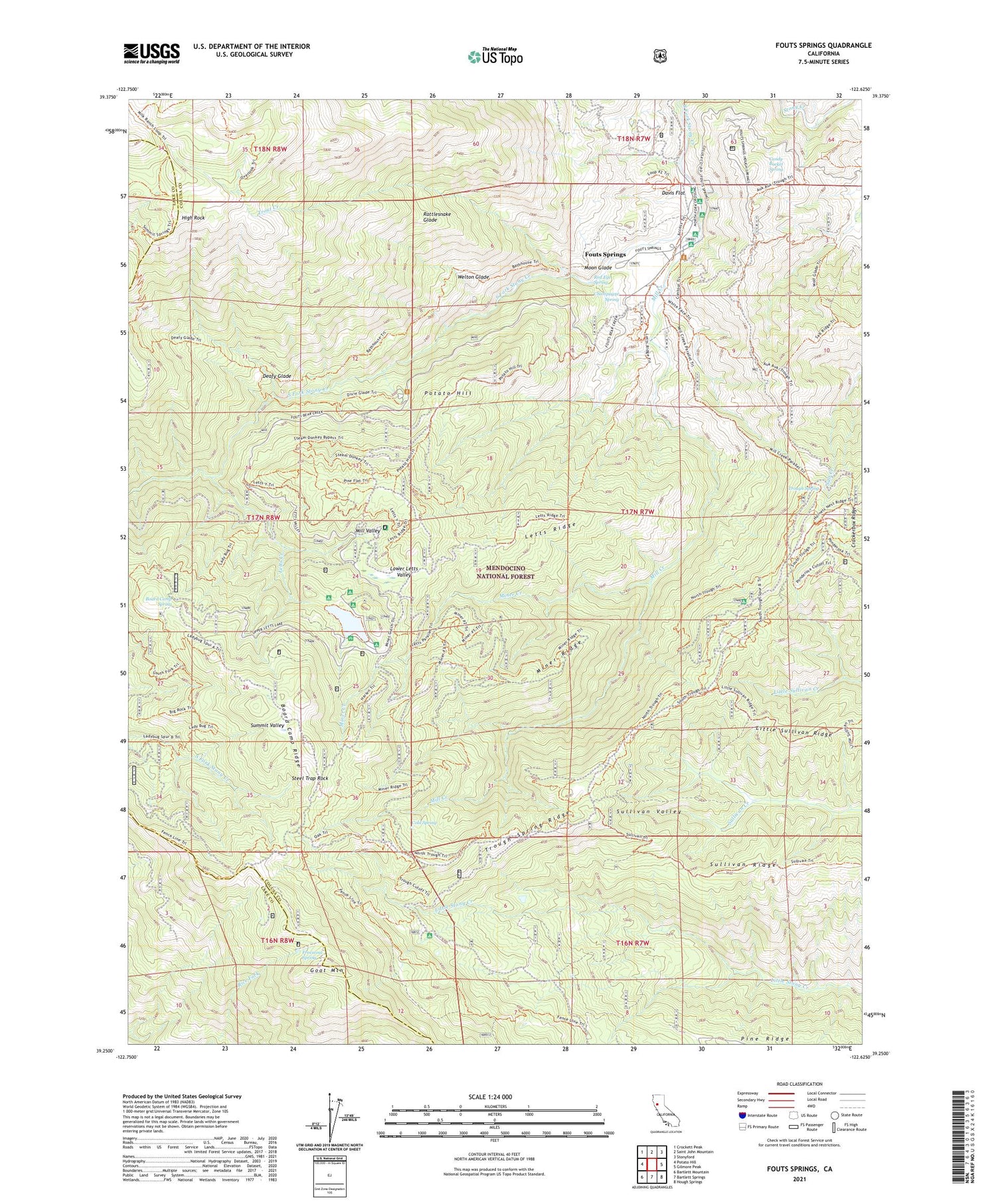
Fouts Springs California US Topo Map
Couldn't load pickup availability
Also explore the Fouts Springs Forest Service Topo of this same quad for updated USFS data
2021 topographic map quadrangle Fouts Springs in the state of California. Scale: 1:24000. Based on the newly updated USGS 7.5' US Topo map series, this map is in the following counties: Colusa, Lake. The map contains contour data, water features, and other items you are used to seeing on USGS maps, but also has updated roads and other features. This is the next generation of topographic maps. Printed on high-quality waterproof paper with UV fade-resistant inks.
Quads adjacent to this one:
West: Potato Hill
Northwest: Crockett Peak
North: Saint John Mountain
Northeast: Stonyford
East: Gilmore Peak
Southeast: Hough Springs
South: Bartlett Springs
Southwest: Bartlett Mountain
This map covers the same area as the classic USGS quad with code o39122c6.
Contains the following named places: Bathhouse Trail, Black Oak Campground, Board Camp Ridge, Board Camp Spring, Box Spring Loop, Candy Bucket Spring, Cedar Camp, Champagne Spring, Cold Spring, Davis Flat, Deafy Glade, Deafy Glade Trailhead Parking, Fouts Camp, Fouts Recreation Site, Fouts Springs, Freezeout Spring, Goat Mountain, High Rock, Horse Glade Camp, Letts Creek, Letts Recreation Site, Letts Ridge, Letts Valley 1-039 Dam, Lily Pond, Little Sullivan Ridge, Lower Letts Valley, McDaniel Recreation site, Milk Ranch Trail, Mill Creek, Mill Creek Recreation Site, Mill Valley, Mill Valley Campground, Miner Creek, Miner Ridge, Moon Glade, Old Mill Campground, Pine Ridge, Potato Hill, Rattlesnake Glade, Red Eye Spring, Red Rock Cabin, Sanborn Cabin, Steel Trap Rock, Sullivan Ridge, Summit Valley, Trough Spring, Trough Spring Ridge, Trout Creek, Trout Creek Trail, Trout Creek Trailhead Parking, Upper Letts Lake, Welton Glade