MyTopo
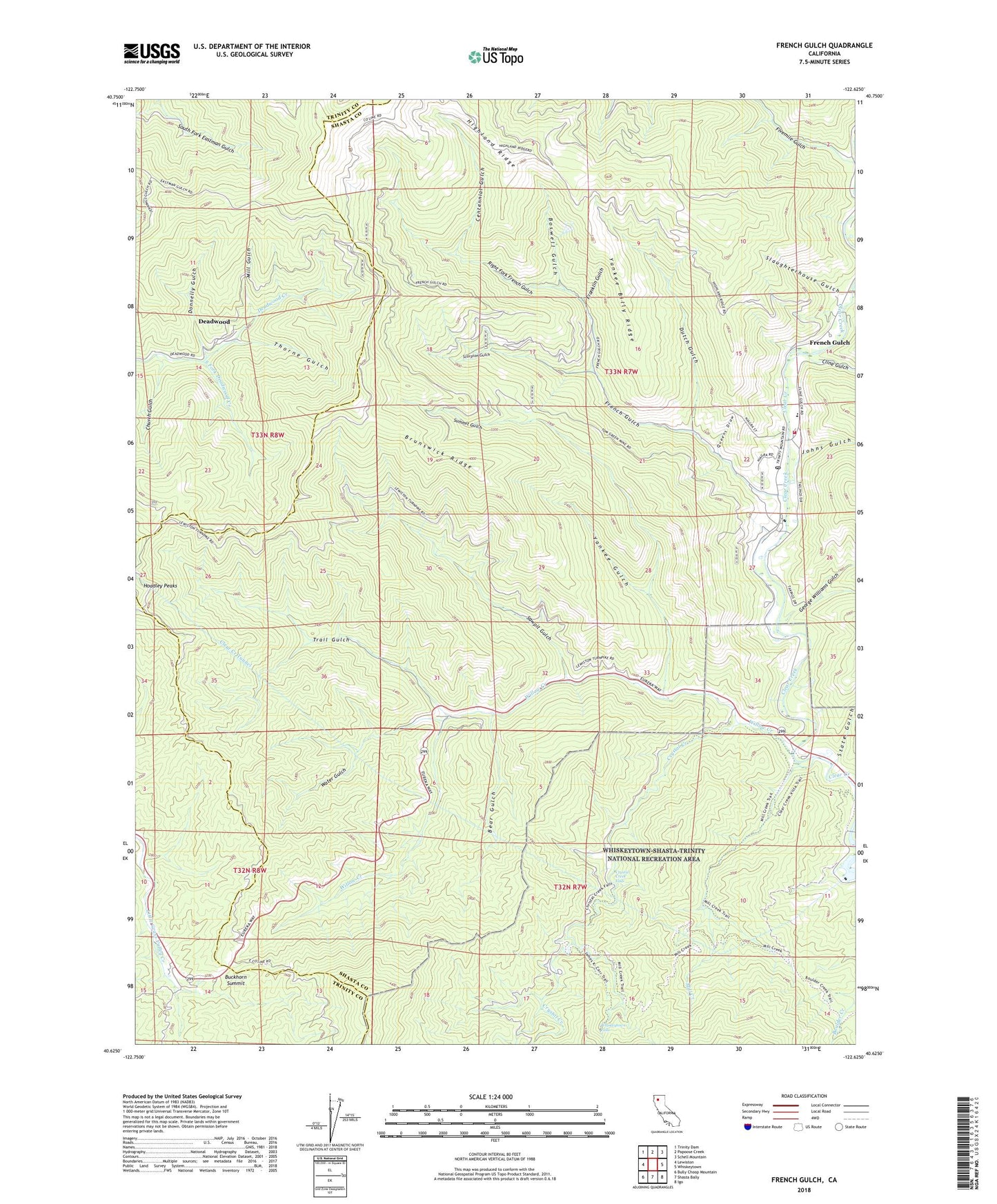
French Gulch California US Topo Map
Couldn't load pickup availability
Also explore the French Gulch Forest Service Topo of this same quad for updated USFS data
2022 topographic map quadrangle French Gulch in the state of California. Scale: 1:24000. Based on the newly updated USGS 7.5' US Topo map series, this map is in the following counties: Shasta, Trinity. The map contains contour data, water features, and other items you are used to seeing on USGS maps, but also has updated roads and other features. This is the next generation of topographic maps. Printed on high-quality waterproof paper with UV fade-resistant inks.
Quads adjacent to this one:
West: Lewiston
Northwest: Trinity Dam
North: Papoose Creek
Northeast: Schell Mountain
East: Whiskeytown
Southeast: Igo
South: Shasta Bally
Southwest: Bully Choop Mountain
This map covers the same area as the classic USGS quad with code o40122f6.
Contains the following named places: Bear Gulch, Black Tom Mine, Boswell Gulch, Brown Bear Mine, Brunswick Mine, Brunswick Ridge, Buckhorn Summit, Centennial Gulch, Church Gulch, Clear Creek Tunnel, Cline Gulch, Crystal Creek, Crystal Creek Conservation Camp, Crystal Creek Falls, Deadwood, Donnelly Gulch, Dutch Gulch, El Dorado Mine, Fivemile Gulch, Franklin Gulch, Franklin Mine, French Gulch, French Gulch - Whiskeytown Elementary School, French Gulch Cemetery, French Gulch Census Designated Place, French Gulch County Park, French Gulch Historic District, French Gulch Post Office, French Gulch Volunteer Fire Company, George Williams Gulch, Johns Gulch, Judge Carr Powerplant, Milkmaid Mine, Mill Creek, Mill Gulch, Niagara Mine, Niagara Summit Mine, Philladelphia Mine, Queens Draw, Right Fork French Gulch, Sawpit Gulch, Scorpion Gulch, Scorpion Mine, Shingle Shanty, Slaughterhouse Gulch, South Fork Deadwood Creek, State Gulch, Summit Gulch, Summit Mine, Thorne Gulch, Tom Green Mine, Tower House, Trail Gulch, Washington Mine, Water Gulch, Whiskeytown Falls, Willow Creek, Yankee Billy Ridge, Yankee Gulch