MyTopo
Whiskeytown California US Topo Map
Couldn't load pickup availability
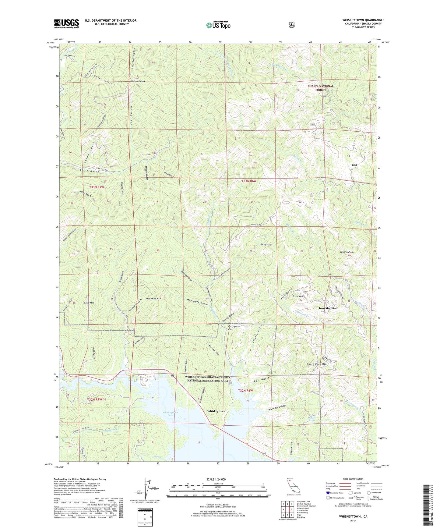
2023 topographic map quadrangle Whiskeytown in the state of California. Scale: 1:24000. Based on the newly updated USGS 7.5' US Topo map series, this map is in the following counties: Shasta. The map contains contour data, water features, and other items you are used to seeing on USGS maps, but also has updated roads and other features. This is the next generation of topographic maps. Printed on high-quality waterproof paper with UV fade-resistant inks.
Quads adjacent to this one:
West: French Gulch
Northwest: Papoose Creek
North: Schell Mountain
Northeast: Bohemotash Mountain
East: Shasta Dam
Southeast: Redding
South: Igo
Southwest: Shasta Bally
This map covers the same area as the classic USGS quad with code o40122f5.
Contains the following named places: Balaklaia Mine, Boulder Creek, Bright Star Mine, Bull Gulch, China Gulch, Deadwood Gulch, Desmond Mine, Drunken Gulch, Dry Creek, Dry Creek Campground, Early Bird Mine, Eiler Mine, Ganim Mine, Gladstone Mine, Great Verde Prospect, Grizzly Gulch, Hopper Gulch, Iron Mountain, Iron Mountain Mine, Jic Gulch, KEWB-FM (Anderson), KSHA-FM (Redding), KVIP-FM (Redding), Liberty Gulch, Lone Star Prospect, Mad Mule Gulch, Mad Mule Mine, Mad Mule Mountain, Mad Ox Gulch, Mad Ox Mine, Marlowe Gulch, Merry Mountain, Mexican Spring, Minnesota Mine, Modesty Gulch, Murderers Gulch, New York Gulch, North Star Mine, Oak Bottom, Oak Bottom Campground, Oak Bottom Campround, Old American Mine, Portuguese Flat, Red Gulch, Rippley Gulch, Shirttail Peak, Slickrock Creek, Slug Gulch, South Fork Mountain, Spanish Gulch, Spring Gulch, Stone Gulch, Stowell Mine, Studhorse Gulch, Sugarloaf Mountain, Sugarloaf Prospect, Whiskey Creek, Whiskey Creek Picnic Area, Whiskeytown, Whiskeytown Lake, White Rock Gulch