MyTopo
Shasta Bally California US Topo Map
Couldn't load pickup availability
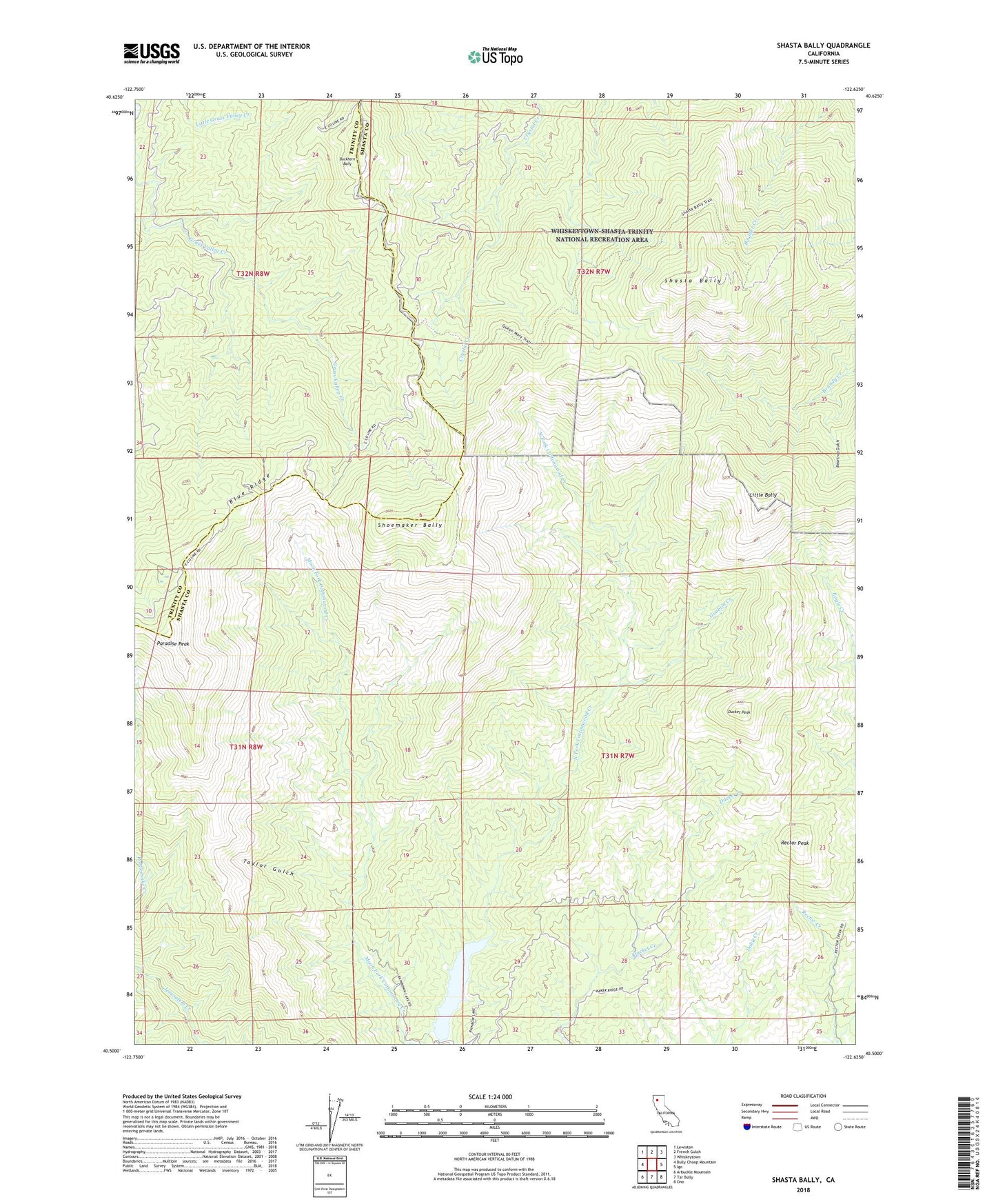
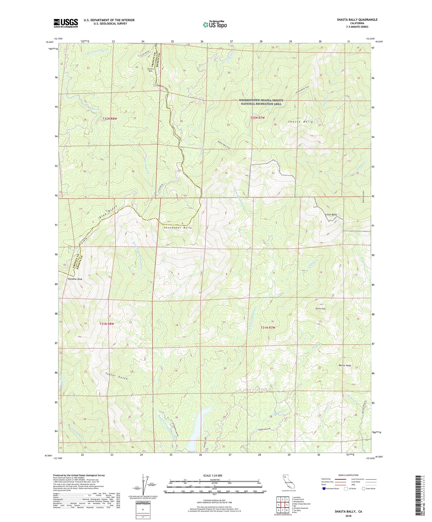
2022 topographic map quadrangle Shasta Bally in the state of California. Scale: 1:24000. Based on the newly updated USGS 7.5' US Topo map series, this map is in the following counties: Shasta, Trinity. The map contains contour data, water features, and other items you are used to seeing on USGS maps, but also has updated roads and other features. This is the next generation of topographic maps. Printed on high-quality waterproof paper with UV fade-resistant inks.
Quads adjacent to this one:
West: Bully Choop Mountain
Northwest: Lewiston
North: French Gulch
Northeast: Whiskeytown
East: Igo
Southeast: Ono
South: Tar Bully
Southwest: Arbuckle Mountain
This map covers the same area as the classic USGS quad with code o40122e6.
Contains the following named places: Beartrap Gulch, Blue Ridge, Buckhorn Bally, Coggins Park, Ducket Peak, Gimblin Creek, KIXE-TV (Redding), KNCQ-FM (Redding), KRCR-TV (Redding), KVIP-FM (Redding), Little Bally, Musselbeck Dam, Paradise Peak, Rainbow Lake, Rector Peak, Shasta Bally, Shoemaker Bally, Southwest Shasta Division, Taylor Gulch, ZIP Code: 96087