MyTopo
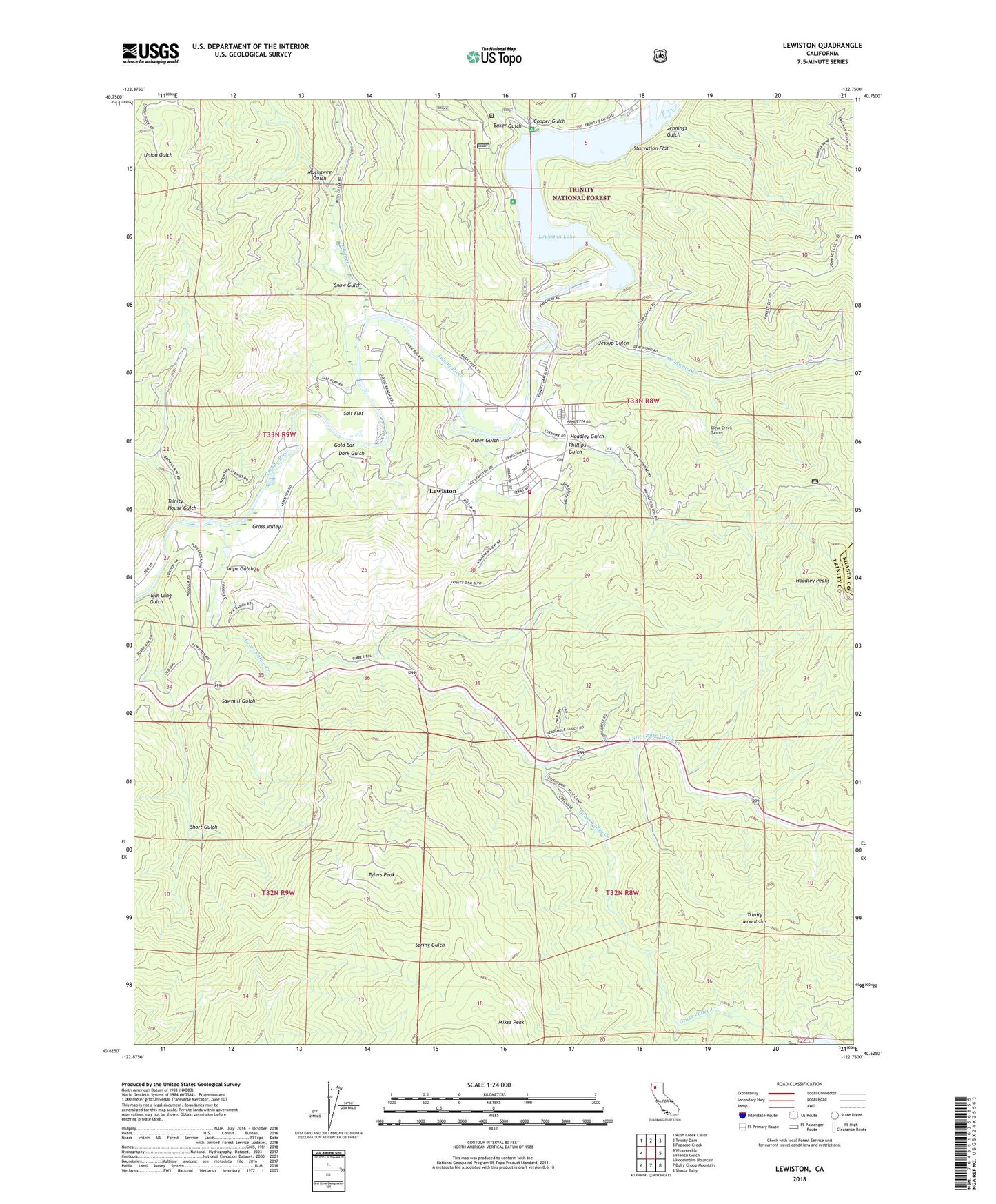
Lewiston California US Topo Map
Couldn't load pickup availability
Also explore the Lewiston Forest Service Topo of this same quad for updated USFS data
2022 topographic map quadrangle Lewiston in the state of California. Scale: 1:24000. Based on the newly updated USGS 7.5' US Topo map series, this map is in the following counties: Trinity, Shasta. The map contains contour data, water features, and other items you are used to seeing on USGS maps, but also has updated roads and other features. This is the next generation of topographic maps. Printed on high-quality waterproof paper with UV fade-resistant inks.
Quads adjacent to this one:
West: Weaverville
Northwest: Rush Creek Lakes
North: Trinity Dam
Northeast: Papoose Creek
East: French Gulch
Southeast: Shasta Bally
South: Bully Choop Mountain
Southwest: Hoosimbim Mountain
This map covers the same area as the classic USGS quad with code o40122f7.
Contains the following named places: Alder Gulch, Baker Gulch, Browns Mountain, Buckhorn Station, Bucktail, Cooper Gulch, Cooper Gulch Campground, Dark Gulch, Deadwood Creek, Ellen Pickett State Forest, Fawn Lodge, Fawn Lodge Forest Service Station, Gold Bar, Grass Valley, Grass Valley Creek, Hoadley Gulch, Hoadley Peaks, Independent Order of Odd Fellows Camp, Jennings Gulch, Jessup Gulch, Lakeview Terrace Campground, Lewiston, Lewiston Cemetery, Lewiston Census Designated Place, Lewiston Community Park, Lewiston Dam, Lewiston Elementary School, Lewiston Historic District, Lewiston Lake, Lewiston Pioneer Cemetery, Lewiston Post Office, Lewiston Volunteer Fire Department, Little Grass Valley Creek, Lowden Ranch, Mary Smith Campground, Mikes Peak, Muckawee Gulch, Old Lewiston School House, Phillips Gulch, Phillips Mine, Posey Gulch, Rush Creek, Salt Flat, Sawmill Gulch, Short Gulch, Snipe Gulch, Snow Gulch, Starvation Flat, Tom Lang Gulch, Trinity House Gulch, Trinity River Fish Hatchery, Tylers Peak, Union Hill Ditch, Vencia Mine, ZIP Code: 96052