MyTopo
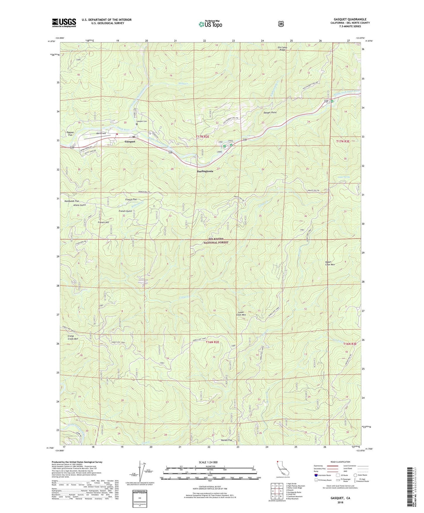
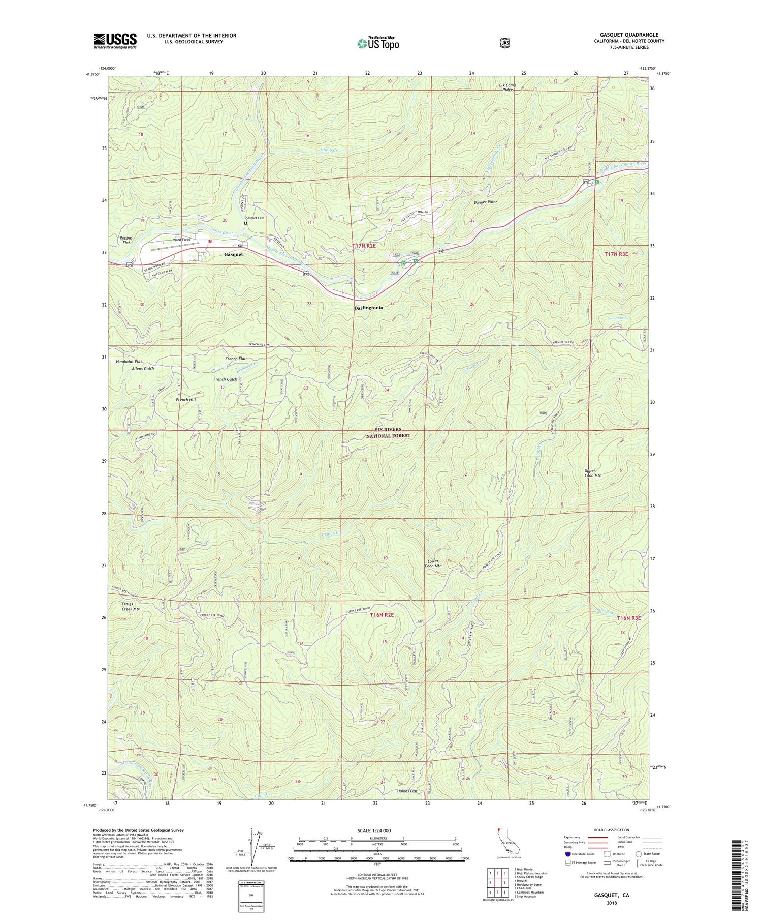
Gasquet California US Topo Map
Couldn't load pickup availability
Also explore the Gasquet Forest Service Topo of this same quad for updated USFS data
2022 topographic map quadrangle Gasquet in the state of California. Scale: 1:24000. Based on the newly updated USGS 7.5' US Topo map series, this map is in the following counties: Del Norte. The map contains contour data, water features, and other items you are used to seeing on USGS maps, but also has updated roads and other features. This is the next generation of topographic maps. Printed on high-quality waterproof paper with UV fade-resistant inks.
Quads adjacent to this one:
West: Hiouchi
Northwest: High Divide
North: High Plateau Mountain
Northeast: Shelly Creek Ridge
East: Hurdygurdy Butte
Southeast: Ship Mountain
South: Canthook Mountain
Southwest: Childs Hill
This map covers the same area as the classic USGS quad with code o41123g8.
Contains the following named places: Adams Station, Angela Mine, Big Dipper Mine, Black Jack Mine, Camp Eight Mine, Camp Six Lookout Tower, Cedar Forest Camp Ground, Cedar Spring, Coon Creek, Coon Creek Number 1 Mine, Cooncan Mine, Craigs Creek Mountain, Danger Point, Darlingtonia, Eighteenmile Creek, Fairview Mine, Fourth of July Mine, French Flat, French Gulch, French Hill, French Hill Placer Mine, French Hill Trail, French Placer Canal, Gasquet, Gasquet Bible Church, Gasquet Cemetery, Gasquet Census Designated Place, Gasquet District Ranger Office, Gasquet Fire Protection District, Gasquet Post Office, Gilmore Mine, Grassy Flat Campground, Hawkins Mine, Humboldt Flat, Lower Coon Mountain, Madrona Camp, Margy Mine, Middle Fork Smith River, Morrell Placer Mine, Mountain Elementary School, Negrohead Mine, North Fork Smith River, Panther Flat Campground, Pappas Flat, Patterson Mine, Redwood Creek, Riverview Camp, Smith Wild and Scenic River, Stony Creek, Sunrise Mine, Tyson Chrome Mine, Ward Field, Zinc Saddle Mine