
MyTopo
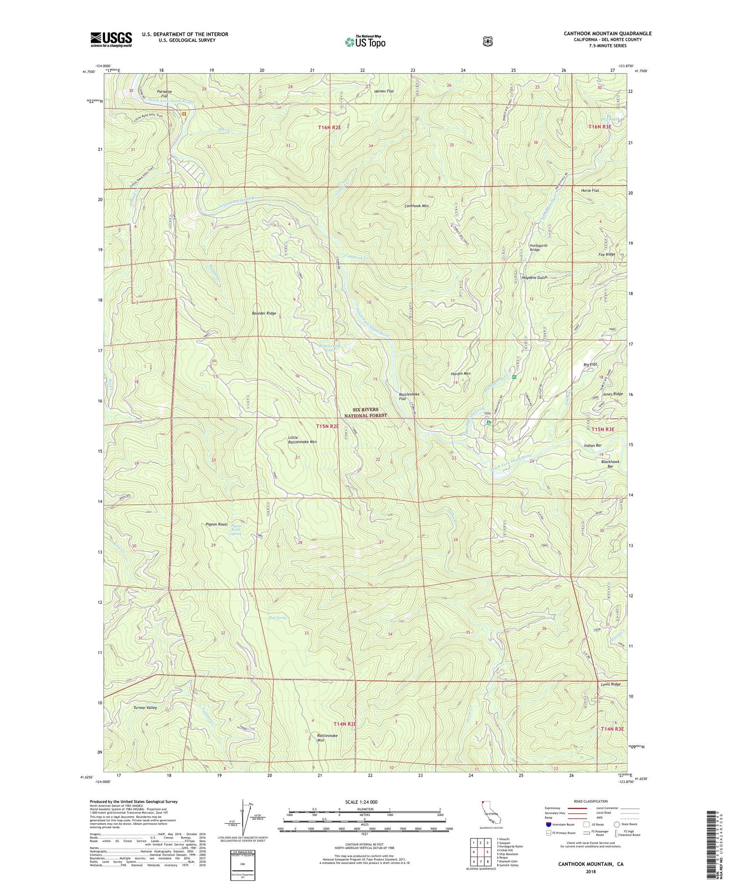
Canthook Mountain California US Topo Map
Couldn't load pickup availability
Also explore the Canthook Mountain Forest Service Topo of this same quad for updated USFS data
2022 topographic map quadrangle Canthook Mountain in the state of California. Scale: 1:24000. Based on the newly updated USGS 7.5' US Topo map series, this map is in the following counties: Del Norte. The map contains contour data, water features, and other items you are used to seeing on USGS maps, but also has updated roads and other features. This is the next generation of topographic maps. Printed on high-quality waterproof paper with UV fade-resistant inks.
Quads adjacent to this one:
West: Childs Hill
Northwest: Hiouchi
North: Gasquet
Northeast: Hurdygurdy Butte
East: Ship Mountain
Southeast: Summit Valley
South: Klamath Glen
Southwest: Requa
Contains the following named places: Alma Ranch, Big Flat, Big Flat Campground, Big Flat Forest Service Station, Blackhawk Creek, Boulder Creek, Boulder Ridge, Cable Crossing, Canthook Creek, Canthook Mountain, Canthook Prairie, China Mine, Chrome Mine, Deer Creek, Del Norte County, Dry Lake, Goose Creek, Gordon Creek, Haines Flat, Hardin Mountain, Haydens Gulch, Horse Flat, Hurdygurdy Bridge, Hurdygurdy Creek, Indian Bar, Jones Creek, Knapp Estate, Little Rattlesnake Lookout, Little Rattlesnake Mountain, Melson Ranch, Mud Spring, Paradise Flat, Paradise Ranch, Paradise Trail, Pigeon Roost, Pigeon Roost Spring, Rattlesnake Flat, Rattlesnake Lake, Rattlesnake Trail, Rock Creek, Rock Creek Camp, Soldier Well, Stevens Ranch, Wilson Ranch


