MyTopo
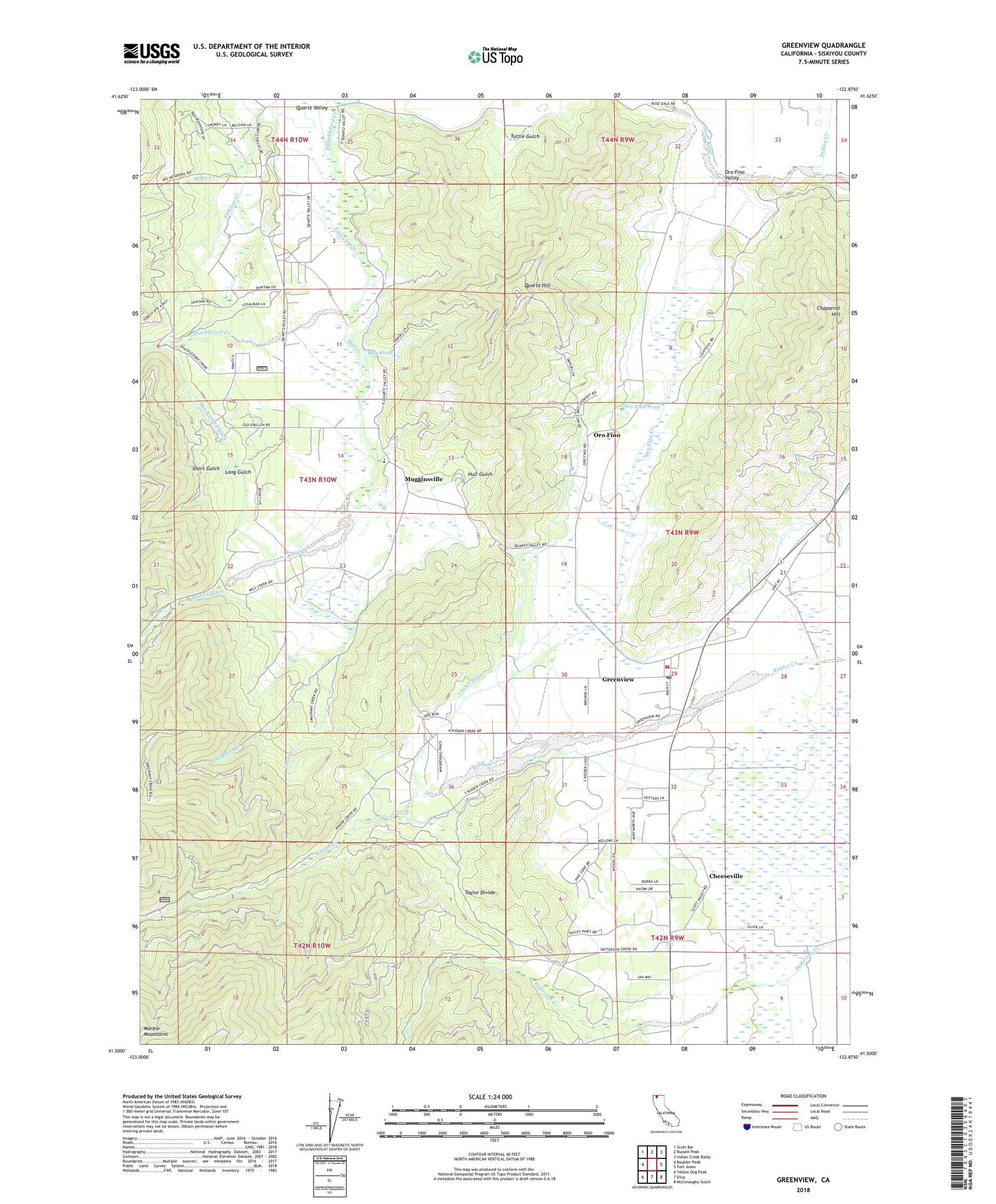
Greenview California US Topo Map
Couldn't load pickup availability
Also explore the Greenview Forest Service Topo of this same quad for updated USFS data
2021 topographic map quadrangle Greenview in the state of California. Scale: 1:24000. Based on the newly updated USGS 7.5' US Topo map series, this map is in the following counties: Siskiyou. The map contains contour data, water features, and other items you are used to seeing on USGS maps, but also has updated roads and other features. This is the next generation of topographic maps. Printed on high-quality waterproof paper with UV fade-resistant inks.
Quads adjacent to this one:
West: Boulder Peak
Northwest: Scott Bar
North: Russell Peak
Northeast: Indian Creek Baldy
East: Fort Jones
Southeast: McConaughy Gulch
South: Etna
Southwest: Yellow Dog Peak
This map covers the same area as the classic USGS quad with code o41122e8.
Contains the following named places: Alder Creek, Blue Pond, Chaparral Hill, Charity Mission, Cheeseville, Custer Ditch, Emigrant Creek, Evans Creek, Fino Mine, Fretis Ditch, Friden Ditch, Gibraltar Mine, Gold Reef Mine, Gold Reel Mine, Golden Seal Mine, Greenview, Greenview Census Designated Place, Greenview Ditch, Greenview Post Office, Hull Gulch, Indian Creek, Johnson Mine, Kindig Camp, Long Gulch, Mill Creek, Mill Creek Ditch, Mill Creek School, Morrison-Carlock Mine, Mugginsville, Oro Fino, Oro Fino Creek, Oro Fino Pond, Oro Fino Valley, Providence Mine, Quartz Hill, Quartz Lookout, Quartz Valley Elementary School, Quartz Valley Reservation, Quartz Valley School, Rattlesnake Creek, Scott Valley Fire Protection District Greenview, Shackleford Ditch, Short Gulch, Star Mine, Taylor Divide, Tuttle Gulch, Umpah Mine, ZIP Codes: 96032, 96037