MyTopo
Boulder Peak California US Topo Map
Couldn't load pickup availability
Also explore the Boulder Peak Forest Service Topo of this same quad for updated USFS data
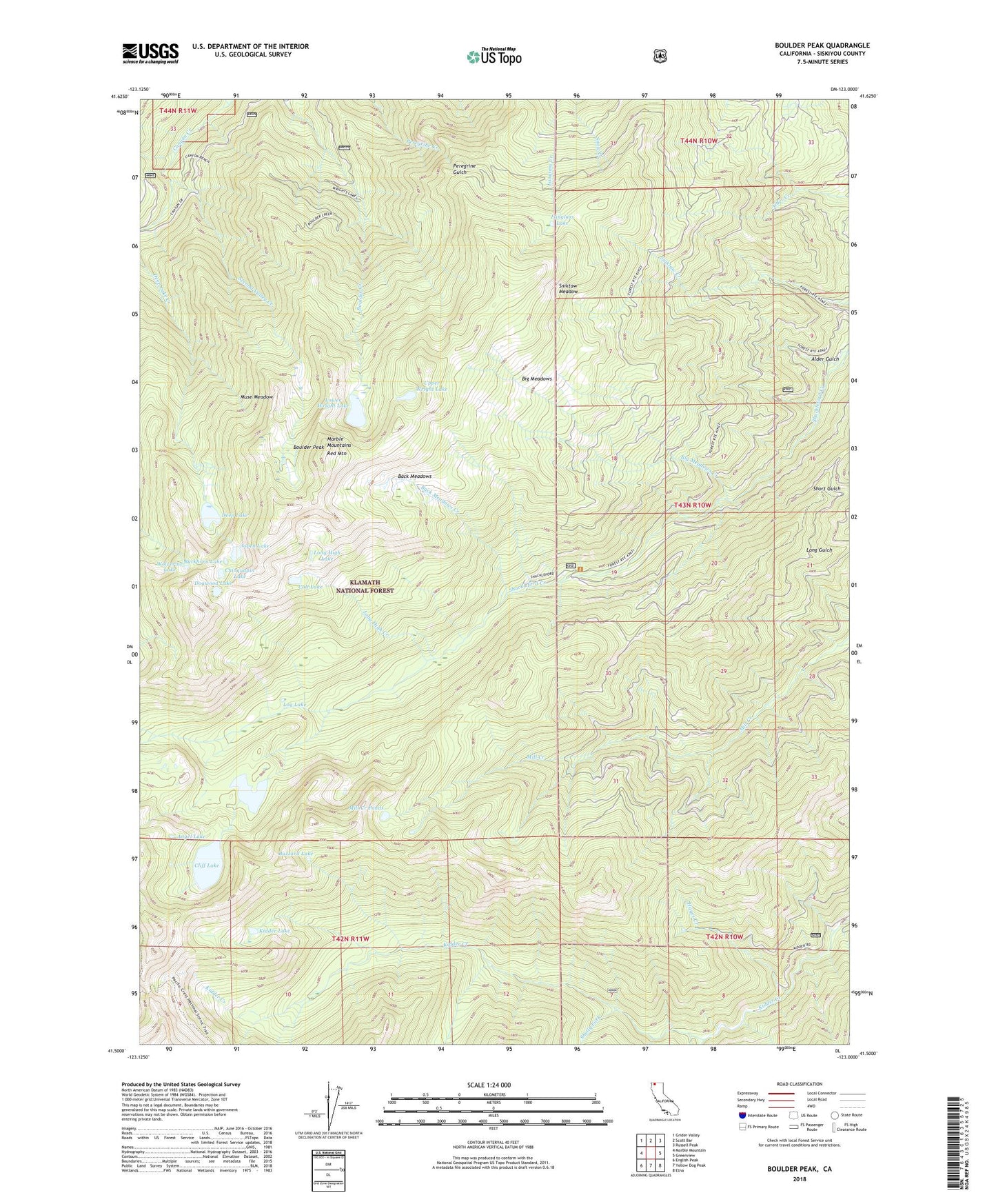
2021 topographic map quadrangle Boulder Peak in the state of California. Scale: 1:24000. Based on the newly updated USGS 7.5' US Topo map series, this map is in the following counties: Siskiyou. The map contains contour data, water features, and other items you are used to seeing on USGS maps, but also has updated roads and other features. This is the next generation of topographic maps. Printed on high-quality waterproof paper with UV fade-resistant inks.
Quads adjacent to this one:
West: Marble Mountain
Northwest: Grider Valley
North: Scott Bar
Northeast: Russell Peak
East: Greenview
Southeast: Etna
South: Yellow Dog Peak
Southwest: English Peak
This map covers the same area as the classic USGS quad with code o41123e1.
Contains the following named places: Alder Gulch, Angel Lake, Aspen Lake, Babs Fork, Back Meadows, Back Meadows Creek, Big Meadows, Big Meadows Creek, Boulder Peak, Buckhorn Lake, Buzzard Lake, Calf Lake, Campbell Lake, Campbell Lake 180 Dam, Chinquapin Lake, Cliff Lake, Deep Lake, Dogwood Lake, Glendenning Fork, Hayes Creek, Isinglass Lake, Kidder Lake, Log Lake, Long High Creek, Long High Lake, Lower Wright Lake, Marble Mountains, Mill Creek Ponds, Muse Meadow, Red Mountain, Second Valley Creek, Shelly Fork, Sniktaw Meadow, Upper Wright Lake, Wolverine Lake