MyTopo
Yellow Dog Peak California US Topo Map
Couldn't load pickup availability
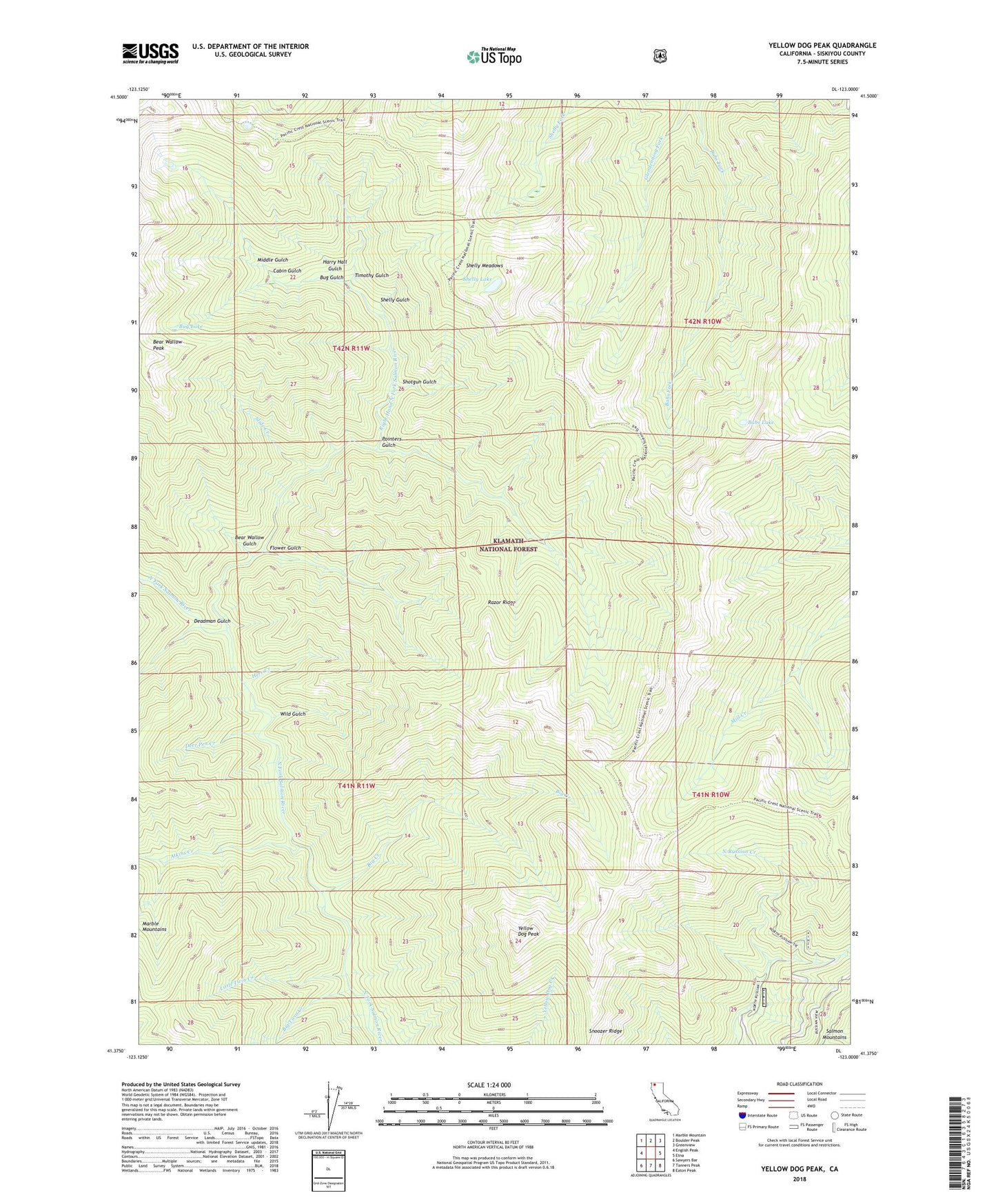
2021 topographic map quadrangle Yellow Dog Peak in the state of California. Scale: 1:24000. Based on the newly updated USGS 7.5' US Topo map series, this map is in the following counties: Siskiyou. The map contains contour data, water features, and other items you are used to seeing on USGS maps, but also has updated roads and other features. This is the next generation of topographic maps. Printed on high-quality waterproof paper with UV fade-resistant inks.
Quads adjacent to this one:
West: English Peak
Northwest: Marble Mountain
North: Boulder Peak
Northeast: Greenview
East: Etna
Southeast: Eaton Peak
South: Tanners Peak
Southwest: Sawyers Bar
This map covers the same area as the classic USGS quad with code o41123d1.
Contains the following named places: Abbott Ranch, Atkins Creek, Babs Lake, Bear Wallow Gulch, Bear Wallow Peak, Big Creek, Big Twin Creek, Bug Gulch, Bug Lake, Cabin Gulch, Deadman Gulch, Deer Pen Creek, Flower Gulch, Harry Hall Gulch, Herr Creek, J Joe Curve, Little Twin Creek, Middle Gulch, Pointers Gulch, Razor Ridge, Right Hand Fork North Fork Salmon River, Shelly Gulch, Shelly Lake, Shelly Meadows, Shotgun Gulch, Slide Creek, Snoozer Ridge, The Cedars, Timothy Gulch, Wild Gulch, Wilson Cabin, Yellow Dog Peak, ZIP Code: 96027