MyTopo
Grimes California US Topo Map
Couldn't load pickup availability
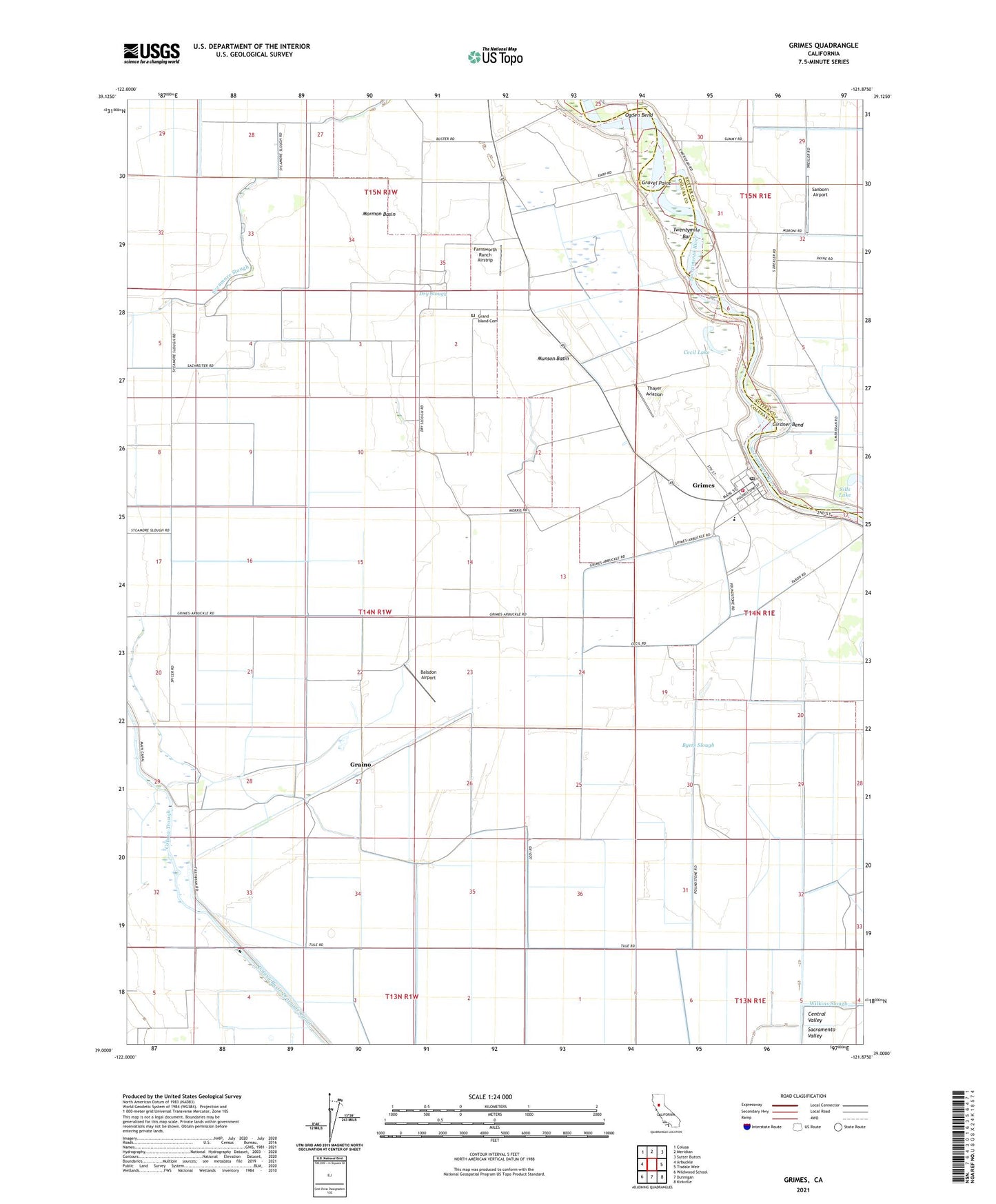
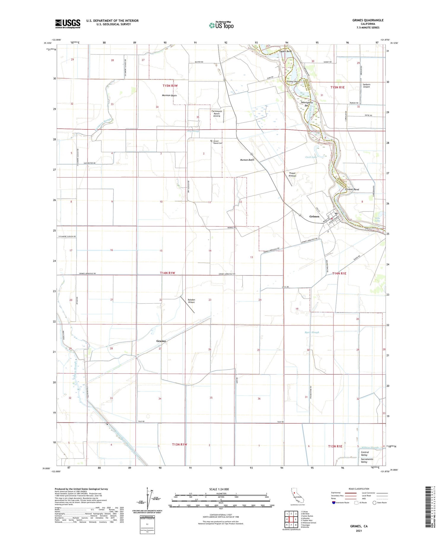
2021 topographic map quadrangle Grimes in the state of California. Scale: 1:24000. Based on the newly updated USGS 7.5' US Topo map series, this map is in the following counties: Colusa, Sutter. The map contains contour data, water features, and other items you are used to seeing on USGS maps, but also has updated roads and other features. This is the next generation of topographic maps. Printed on high-quality waterproof paper with UV fade-resistant inks.
Quads adjacent to this one:
West: Arbuckle
Northwest: Colusa
North: Meridian
Northeast: Sutter Buttes
East: Tisdale Weir
Southeast: Kirkville
South: Dunnigan
Southwest: Wildwood School
This map covers the same area as the classic USGS quad with code o39121a8.
Contains the following named places: Balsdon Airport, Byers Slough, Cecil Lake, Dry Slough, Farnsworth Ranch Airstrip, Girdner Bend, Graino, Grand Island Cemetery, Grand Island Elementary School, Gravel Point, Grimes, Grimes Census Designated Place, Grimes Post Office, Hannum Bridge, Jimeno, Mormon Basin, Munson Basin, Ogden Bend, Sacramento River Fire Protection District Grand Island Station, Sanborn Airport, Sills Lake, Sycamore Siding, Sycamore Slough, Thayer Aviation, Twentymile Bar, ZIP Code: 95950