MyTopo
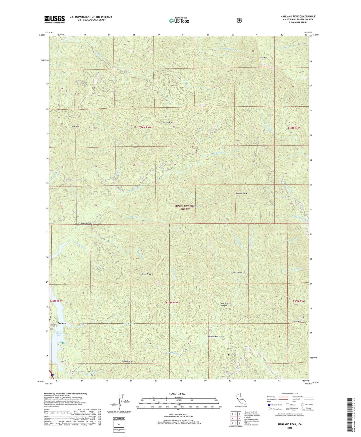
Hanland Peak California US Topo Map
Couldn't load pickup availability
Also explore the Hanland Peak Forest Service Topo of this same quad for updated USFS data
2022 topographic map quadrangle Hanland Peak in the state of California. Scale: 1:24000. Based on the newly updated USGS 7.5' US Topo map series, this map is in the following counties: Shasta. The map contains contour data, water features, and other items you are used to seeing on USGS maps, but also has updated roads and other features. This is the next generation of topographic maps. Printed on high-quality waterproof paper with UV fade-resistant inks.
Quads adjacent to this one:
West: Lamoine
Northwest: Chicken Hawk Hill
North: Tombstone Mountain
Northeast: Yellowjacket Mountain
East: Bollibokka Mountain
Southeast: Minnesota Mountain
South: O'Brien
Southwest: Bohemotash Mountain
This map covers the same area as the classic USGS quad with code o40122h3.
Contains the following named places: Albert Creek, Antlers, Bastard Canyon, Bucks Peak, Crane Mountain, Doe Gulch, Eye Creek, Fannie Creek, Green Mountain, Gregory Beach Campground, Gregory Creek, Gregory Creek Campground, Hanland Peak, High Mountain, Hirz Mountain, Indian Creek, Indian Spring, Johnny Sisk Creek, Kabyai Creek, Little Kabyai Creek, Long Tom Creek, Matquaw Flat, Middle Salt Creek, North Fork North Salt Creek, North Fork Salt Creek, Rabbit Flat, Sacramento Canyon Division, Sacramento Mountain, Tom Head Creek, West Fork Salt Creek