MyTopo
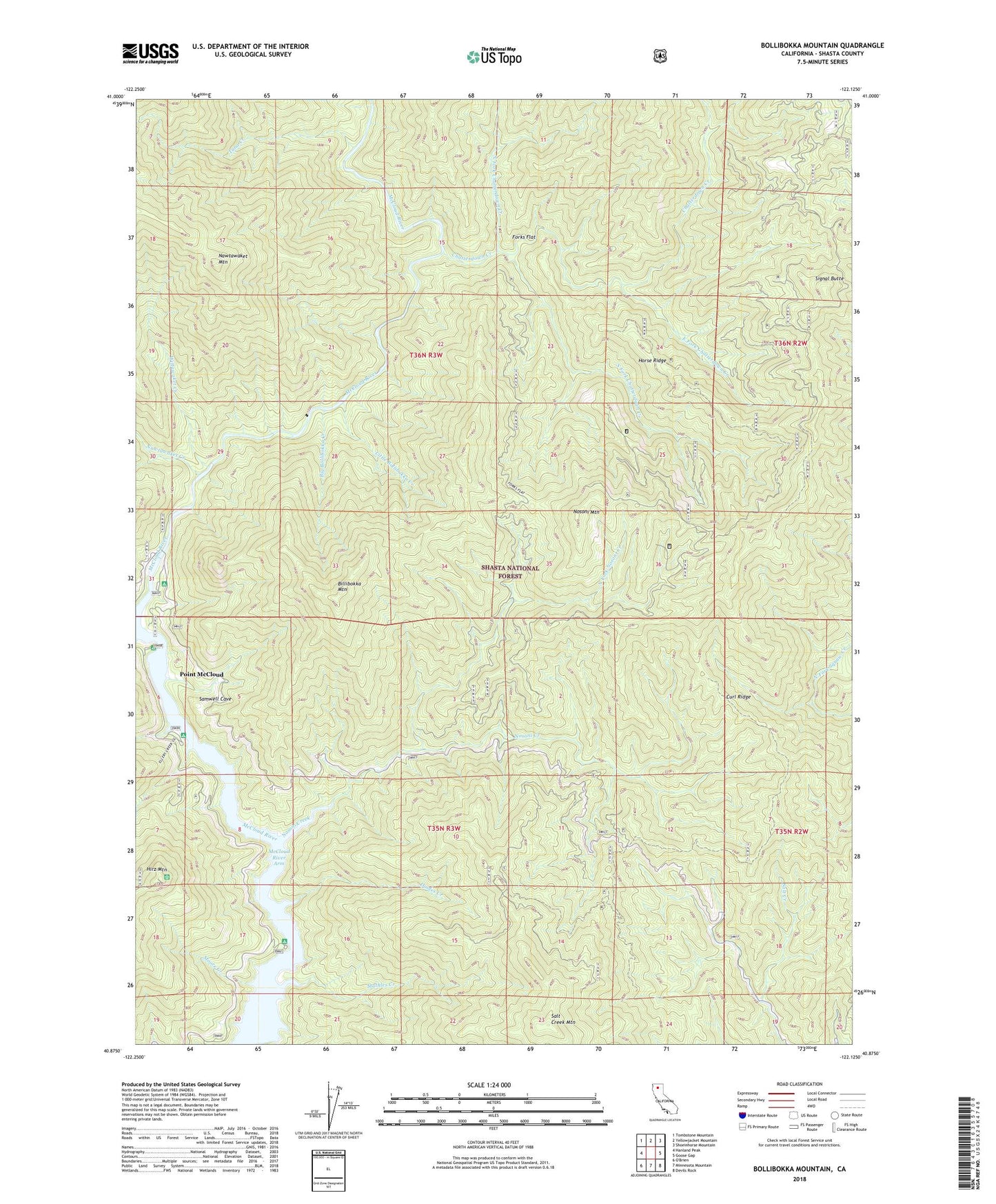
Bollibokka Mountain California US Topo Map
Couldn't load pickup availability
Also explore the Bollibokka Mountain Forest Service Topo of this same quad for updated USFS data
2023 topographic map quadrangle Bollibokka Mountain in the state of California. Scale: 1:24000. Based on the newly updated USGS 7.5' US Topo map series, this map is in the following counties: Shasta. The map contains contour data, water features, and other items you are used to seeing on USGS maps, but also has updated roads and other features. This is the next generation of topographic maps. Printed on high-quality waterproof paper with UV fade-resistant inks.
Quads adjacent to this one:
West: Hanland Peak
Northwest: Tombstone Mountain
North: Yellowjacket Mountain
Northeast: Shoeinhorse Mountain
East: Goose Gap
Southeast: Devils Rock
South: Minnesota Mountain
Southwest: O'Brien
This map covers the same area as the classic USGS quad with code o40122h2.
Contains the following named places: Big Bollibokka Creek, Billibokka Mountain, Bollibokka Club, Chatterdown Creek, Curl Ridge, Dooles Creek, East Fork Chatterdown Creek, Ellery Creek, Ellery Creek Campground, Forks Flat, Horse Ridge, Jennings Creek Camp, Little Bollibokka Creek, Mathles Creek, McCloud Bridge Campground, McCloud Bridge Guard Station, Moore Creek, Moore Creek Campground, Nawtawaket Creek, Nawtawaket Mountain, North Fork Chatterdown Creek, North Fork Nosoni Creek, Nosoni Creek, Nosoni Mountain, Pine Creek, Pine Point Campground, Point McCloud, Salt Creek Mountain, Samwell Cave, Signal Butte, South Fork Chatterdown Creek, Tuna Creek, Wittawaket Creek