MyTopo
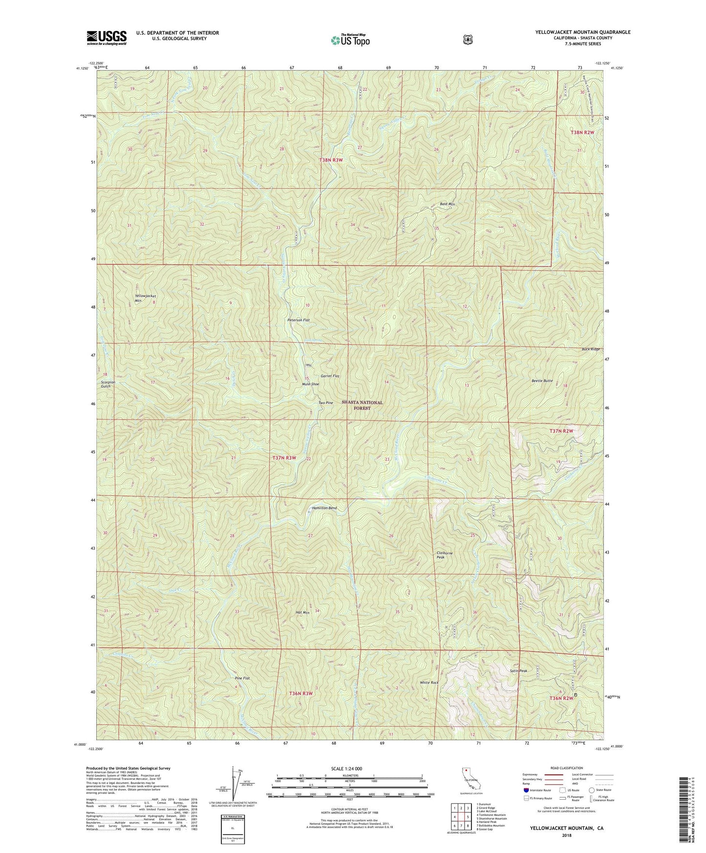
Yellowjacket Mountain California US Topo Map
Couldn't load pickup availability
2023 topographic map quadrangle Yellowjacket Mountain in the state of California. Scale: 1:24000. Based on the newly updated USGS 7.5' US Topo map series, this map is in the following counties: Shasta. The map contains contour data, water features, and other items you are used to seeing on USGS maps, but also has updated roads and other features. This is the next generation of topographic maps. Printed on high-quality waterproof paper with UV fade-resistant inks.
Quads adjacent to this one:
West: Tombstone Mountain
Northwest: Dunsmuir
North: Girard Ridge
Northeast: Lake McCloud
East: Shoeinhorse Mountain
Southeast: Goose Gap
South: Bollibokka Mountain
Southwest: Hanland Peak
This map covers the same area as the classic USGS quad with code o41122a2.
Contains the following named places: Bald Mountain, Bald Mountain Creek, Beartrap Creek, Beetle Butte, Chiquito Creek, Claiborne Creek, Claiborne Peak, Cold Spring, Dutch Creek, Garret Flat, Hamilton Bend, Hat Mountain, Hat Mountain Creek, McCloud River Club, Mule Shoe, North Fork Tom Neal Creek, Oak Creek, Peterson Flat, Pine Flat, Pine Flat Ranger Station, Satin Peak, Scorpion Gulch, South Fork Claiborne Creek, Squaw Valley Creek, Tom Dow Creek, Tom Neal Creek, Trough Creek, Two Pine, White Rock, Yellowjacket Mountain