MyTopo
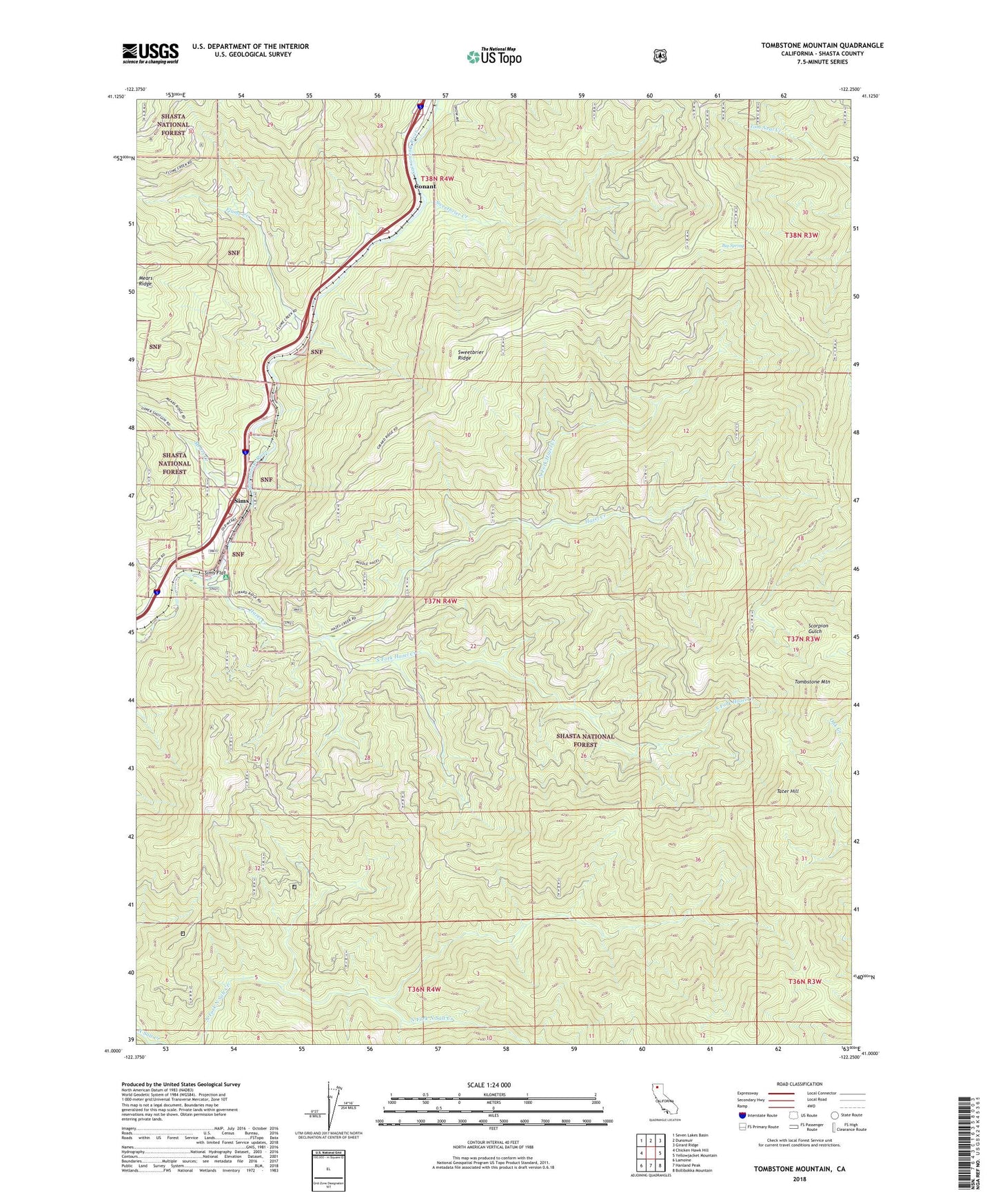
Tombstone Mountain California US Topo Map
Couldn't load pickup availability
Also explore the Tombstone Mountain Forest Service Topo of this same quad for updated USFS data
2022 topographic map quadrangle Tombstone Mountain in the state of California. Scale: 1:24000. Based on the newly updated USGS 7.5' US Topo map series, this map is in the following counties: Shasta. The map contains contour data, water features, and other items you are used to seeing on USGS maps, but also has updated roads and other features. This is the next generation of topographic maps. Printed on high-quality waterproof paper with UV fade-resistant inks.
Quads adjacent to this one:
West: Chicken Hawk Hill
Northwest: Seven Lakes Basin
North: Dunsmuir
Northeast: Girard Ridge
East: Yellowjacket Mountain
Southeast: Bollibokka Mountain
South: Hanland Peak
Southwest: Lamoine
This map covers the same area as the classic USGS quad with code o41122a3.
Contains the following named places: Big Spring, Conant, Flume Creek, Hazel Creek, Mears Creek, North Fork Hazel Creek, Sims, Sims Cemetery, Sims Flat, Sims Flat Campground, Sims Lookout, Sims Station, South Fork Hazel Creek, Sweetbrier Creek, Sweetbrier Ridge, Tater Hill, Tombstone Mountain, Wards Cabin, Wards Upper Cabin, ZIP Code: 96017