MyTopo
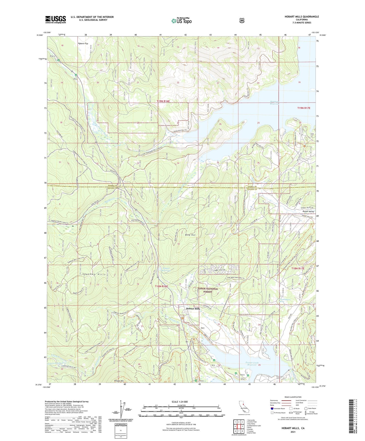
Hobart Mills California US Topo Map
Couldn't load pickup availability
Also explore the Hobart Mills Forest Service Topo of this same quad for updated USFS data
2021 topographic map quadrangle Hobart Mills in the state of California. Scale: 1:24000. Based on the newly updated USGS 7.5' US Topo map series, this map is in the following counties: Nevada, Sierra. The map contains contour data, water features, and other items you are used to seeing on USGS maps, but also has updated roads and other features. This is the next generation of topographic maps. Printed on high-quality waterproof paper with UV fade-resistant inks.
Quads adjacent to this one:
West: Independence Lake
Northwest: Sierraville
North: Sardine Peak
Northeast: Dog Valley
East: Boca
Southeast: Martis Peak
South: Truckee
Southwest: Norden
This map covers the same area as the classic USGS quad with code o39120d2.
Contains the following named places: Alder Creek, Annie McCloud Campground, Billy Hill, Captain Roberts Boat Ramp, Donner Camp Picnic Area, Hobart Mills, Hobart Reservoir, Lakeside Campground, Logger Campground, Lower Little Truckee Campground, North Fork Prosser Creek, Old Smith Mill, Prosser Campground, Prosser Creek Dam, Prosser Creek Reservoir, Prosser Hill, Prosser Ranch Group Campground, Sagehen Creek, Sagehen Creek Campground, South Fork Prosser Creek, Stampede Reservoir, University of California Wildlife Experiment Station, Upper Little Truckee Campground, Winnie Smith Mill, Woodchoppers Spring