MyTopo
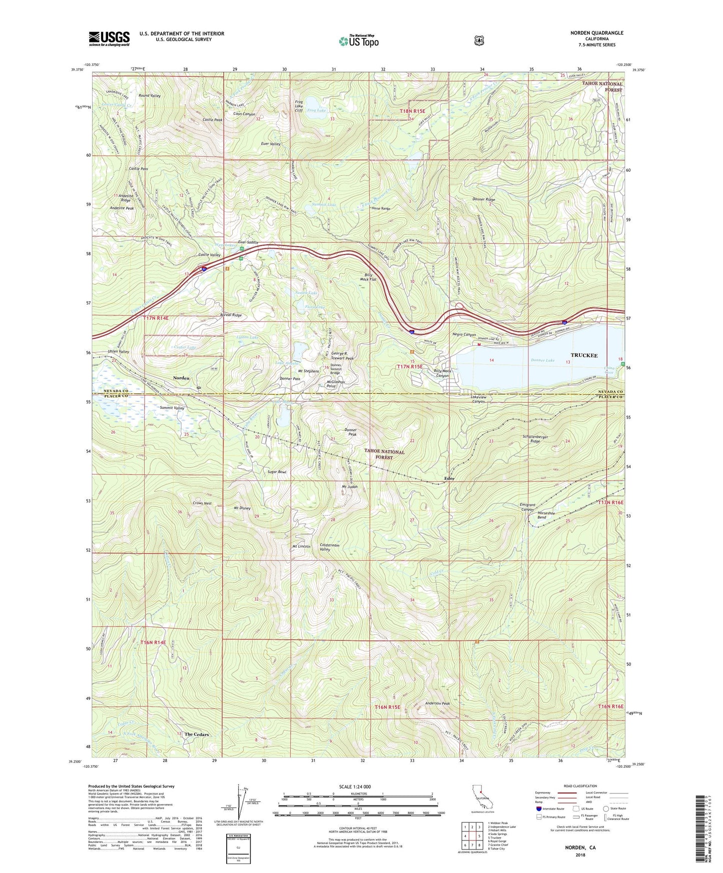
Norden California US Topo Map
Couldn't load pickup availability
Also explore the Norden Forest Service Topo of this same quad for updated USFS data
2022 topographic map quadrangle Norden in the state of California. Scale: 1:24000. Based on the newly updated USGS 7.5' US Topo map series, this map is in the following counties: Placer, Nevada. The map contains contour data, water features, and other items you are used to seeing on USGS maps, but also has updated roads and other features. This is the next generation of topographic maps. Printed on high-quality waterproof paper with UV fade-resistant inks.
Quads adjacent to this one:
West: Soda Springs
Northwest: Webber Peak
North: Independence Lake
Northeast: Hobart Mills
East: Truckee
Southeast: Tahoe City
South: Granite Chief
Southwest: Royal Gorge
This map covers the same area as the classic USGS quad with code o39120c3.
Contains the following named places: Anderson Peak, Andesite Peak, Andesite Ridge, Andover, Azalea Lake, Billy Mack Canyon, Billy Mack Flat, Boreal Ridge, Boreal Ridge Ski Area, Castle Pass, Castle Peak, Castle Valley, Cedar Creek, China Cove, Circle E Ranch, Crater Lake, Crows Nest, Deer Park Recreation Site, Donner, Donner Ever Valley 319 Dam, Donner Lake, Donner Lake Village, Donner Pass, Donner Peak, Donner Ridge, Donner Summit Bridge, Donner Summit Recreation Site, Donner Summit Ski Area, Donner Woods, Eder, Emigrant Canyon, Euer Saddle, Flora Lake, Frog Lake, Frog Lake Cliff, Gelatt, Gelatt Post Office, George R. Stewart Peak, Horse Range, Horseshoe Bend, Lake Angela, Lake Angela 89-002 Dam, Lake Mary, Lake Mary 311-003 Dam, Lake Van Norden, Lakeview, Lakeview Canyon, Lytton Lake, McGlashan Point, Mount Disney, Mount Judah, Mount Lincoln, Mount Stephens, Negro Canyon, Norden, Norden Post Office, Old Stanford Wood Camp, Onion Creek, Onion Creek Campground, Onion Creek Experimental Forest, Peter Grubb Hut, Round Valley, Schallenberger Ridge, South Fork Cold Creek, Southside Highlands, Stanford, Sugar Bowl, Sugar Bowl Ski Area, Summit Lake, Summit Valley, Tahoe Donner Ski Area, The Cedars, Truckee Fire Protection District Station 93 Donner Lake, Uhlen Valley, Upper Alder Creek Picnic Area, Upper Castle Creek, Weeks Tract, West End Beach Park, West Lakes, ZIP Code: 95724