MyTopo
Independence Lake California US Topo Map
Couldn't load pickup availability
Also explore the Independence Lake Forest Service Topo of this same quad for updated USFS data
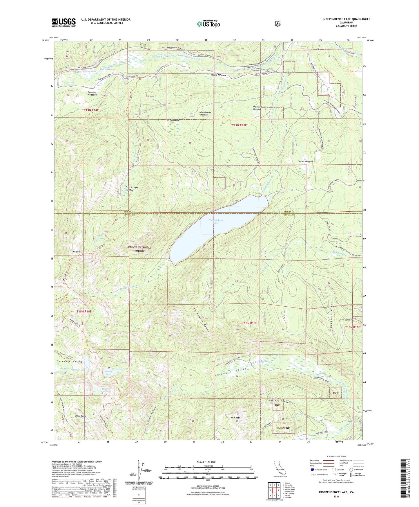
2021 topographic map quadrangle Independence Lake in the state of California. Scale: 1:24000. Based on the newly updated USGS 7.5' US Topo map series, this map is in the following counties: Nevada, Sierra. The map contains contour data, water features, and other items you are used to seeing on USGS maps, but also has updated roads and other features. This is the next generation of topographic maps. Printed on high-quality waterproof paper with UV fade-resistant inks.
Quads adjacent to this one:
West: Webber Peak
Northwest: Sattley
North: Sierraville
Northeast: Sardine Peak
East: Hobart Mills
Southeast: Truckee
South: Norden
Southwest: Soda Springs
This map covers the same area as the classic USGS quad with code o39120d3.
Contains the following named places: Anderson Meadow, Basin Peak, Carpenter Ridge, Carpenter Valley, Cold Stream, Cold Stream Meadow, Coon Canyon, Crabtree Canyon, Devils Oven Lake, Donner Division, Dry Meadow, Euer Valley, Independence 105-006 Dam, Independence Lake, Independence Lake Campground, Little Truckee River, Meathouse Meadow, Mount Lola, Mount Lola Trail, Paradise Lake, Perazzo Meadows, Red Mountain, Saddle Meadow, Sagehen Campground, Sagehen Hills, Secret Meadow, Upper Independence Creek, Warren Lake, Warren Lake Trail