MyTopo
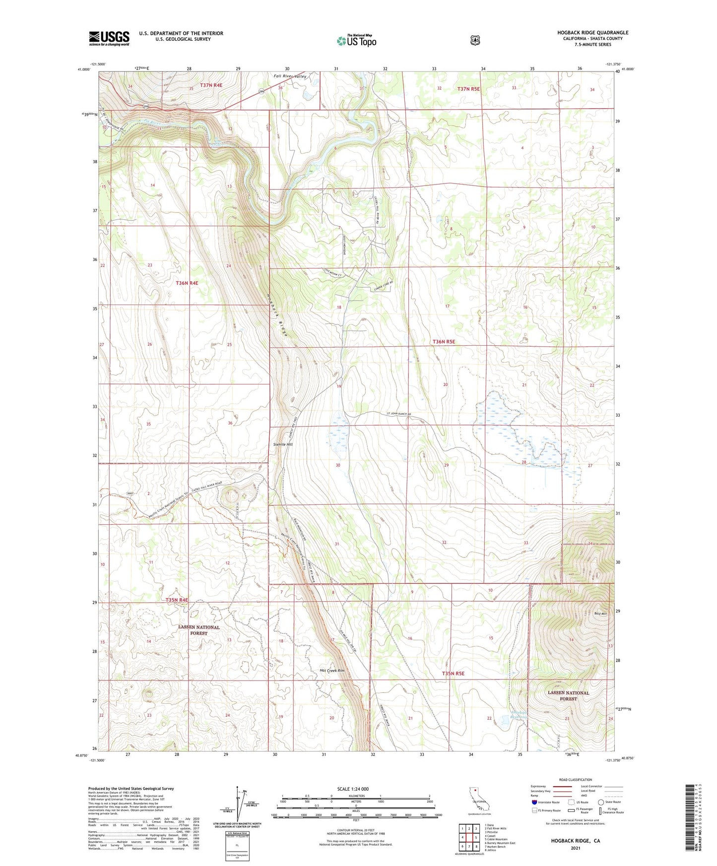
Hogback Ridge California US Topo Map
Couldn't load pickup availability
Also explore the Hogback Ridge Forest Service Topo of this same quad for updated USFS data
2021 topographic map quadrangle Hogback Ridge in the state of California. Scale: 1:24000. Based on the newly updated USGS 7.5' US Topo map series, this map is in the following counties: Shasta. The map contains contour data, water features, and other items you are used to seeing on USGS maps, but also has updated roads and other features. This is the next generation of topographic maps. Printed on high-quality waterproof paper with UV fade-resistant inks.
Quads adjacent to this one:
West: Cassel
Northwest: Dana
North: Fall River Mills
Northeast: Pittville
East: Coble Mountain
Southeast: Jellico
South: Murken Bench
Southwest: Burney Mountain East
This map covers the same area as the classic USGS quad with code o40121h4.
Contains the following named places: Antelope Reservoir, Antelope Reservoir Dam, Bald Mountain, Fall River Quarry B, Fall River Valley, Hogback Ridge, Pit One Powerhouse, Pit River Falls, Saint John Ranch, Sixmile Hill