MyTopo
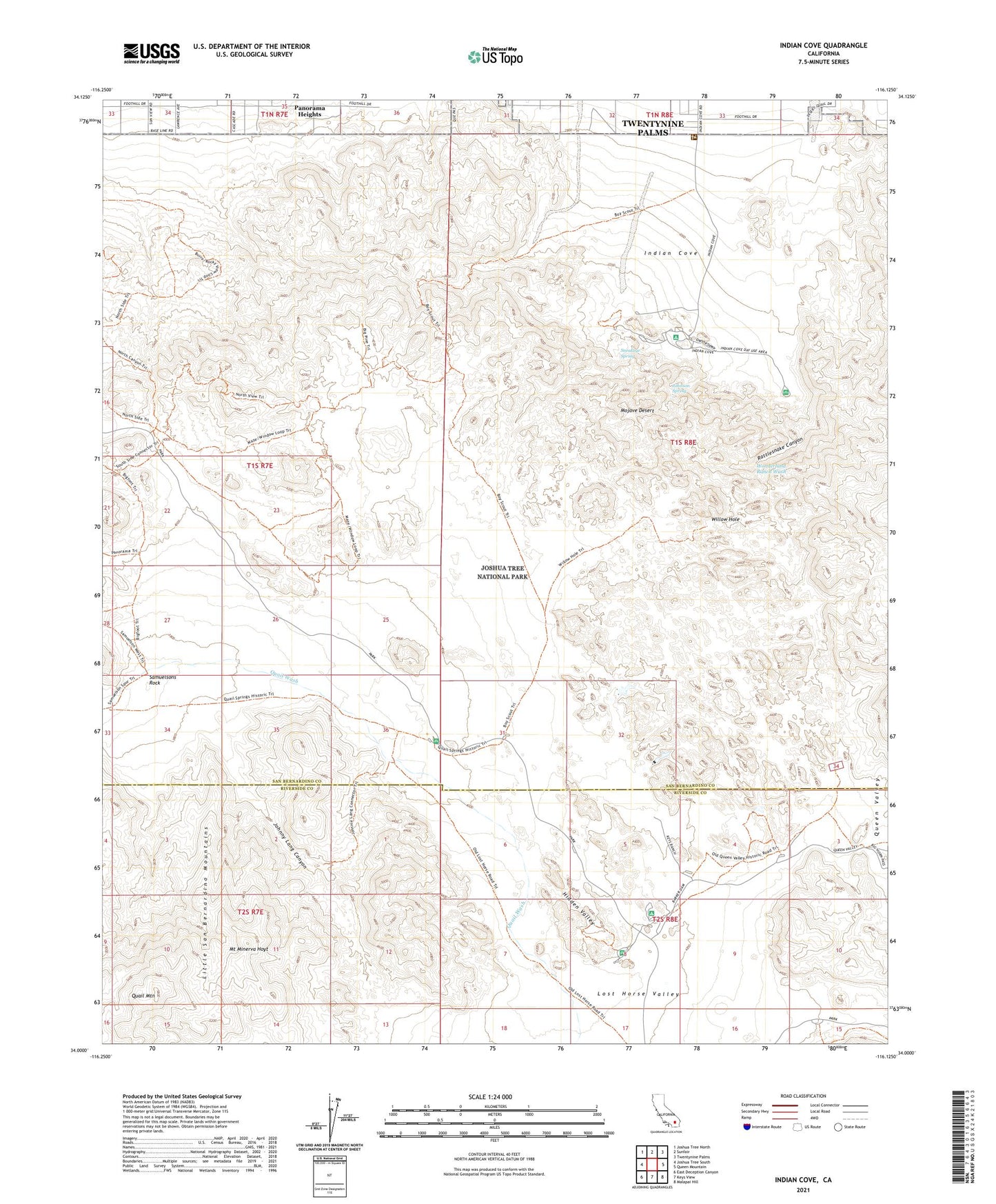
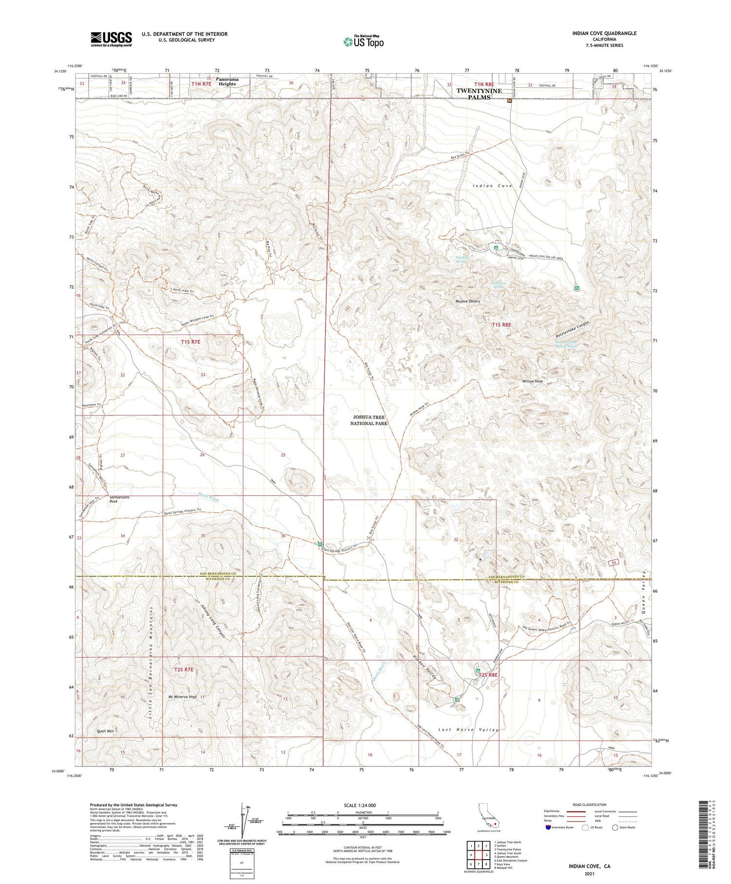
Indian Cove California US Topo Map
Couldn't load pickup availability
2021 topographic map quadrangle Indian Cove in the state of California. Scale: 1:24000. Based on the newly updated USGS 7.5' US Topo map series, this map is in the following counties: San Bernardino, Riverside. The map contains contour data, water features, and other items you are used to seeing on USGS maps, but also has updated roads and other features. This is the next generation of topographic maps. Printed on high-quality waterproof paper with UV fade-resistant inks.
Quads adjacent to this one:
West: Joshua Tree South
Northwest: Joshua Tree North
North: Sunfair
Northeast: Twentynine Palms
East: Queen Mountain
Southeast: Malapai Hill
South: Keys View
Southwest: East Deception Canyon
This map covers the same area as the classic USGS quad with code o34116a2.
Contains the following named places: Barker Dam, Cow Camp Dam, Desert Queen Well, Hidden Valley, Hidden Valley Campground, Indian Cove, Indian Cove Campground, Indian Cove Ranger Station, Johnny Lang Canyon, Johnson Spring, Keys Ranch, Lang Mine, Lost Horse Ranger Station, Lost Horse Valley, Mount Minerva Hoyt, Panorama Heights, Quail Mountain, Rattlesnake Canyon, Ryan Mountain Trail, Samuelsons Rock, Sneakeye Spring, Wall Street Mill, Willow Hole, Wonderland of Rocks, Wonderland Ranch Wash