
MyTopo
Joshua Tree North California US Topo Map
Couldn't load pickup availability
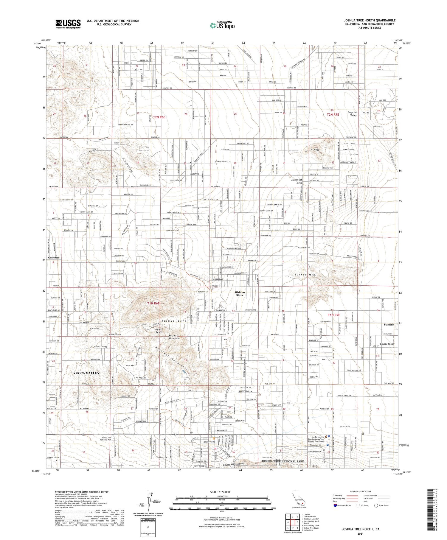
2021 topographic map quadrangle Joshua Tree North in the state of California. Scale: 1:24000. Based on the newly updated USGS 7.5' US Topo map series, this map is in the following counties: San Bernardino. The map contains contour data, water features, and other items you are used to seeing on USGS maps, but also has updated roads and other features. This is the next generation of topographic maps. Printed on high-quality waterproof paper with UV fade-resistant inks.
Quads adjacent to this one:
West: Yucca Valley North
Northwest: Landers
North: Goat Mountain
Northeast: Deadman Lake SW
East: Sunfair
Southeast: Indian Cove
South: Joshua Tree South
Southwest: Yucca Valley South
This map covers the same area as the classic USGS quad with code o34116b3.
Contains the following named places: Bartlett Mountains, Bunker Mountain, California Highway Patrol - Morongo Basin, Coyote Hole Canyon, Coyote Well, Desert Mininstries Christian School, First Baptist Church of Joshua Tree, First Southern Baptist Church of Joshua Tree, Hi - Desert Medical Center, Hidden River, Hi-Desert Memorial Hospital Heliport, Joshua Cove, Joshua Tree, Joshua Tree Branch San Bernardino County Library, Joshua Tree Elementary School, Joshua Tree Foursquare Church, Joshua Tree Memorial Park, Joshua Tree Post Office, KSES-AM (Yucca Valley), Lighthouse Christian Center, Moonlight Mesa, Moronga Basin CHP Heliport, Morongo Basin Ambulance, Mount Nebo, New Testament Baptist Church, Saint Christopher of the Desert Church, San Bernardino County Fire Department Station 36 Joshua Tree, San Bernardino County Sheriff's Office Morongo Basin Station, Surprise Valley, ZIP Code: 92252


