MyTopo
Joshua Tree South California US Topo Map
Couldn't load pickup availability
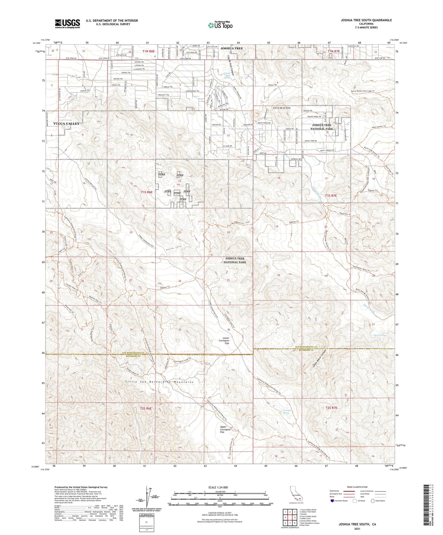
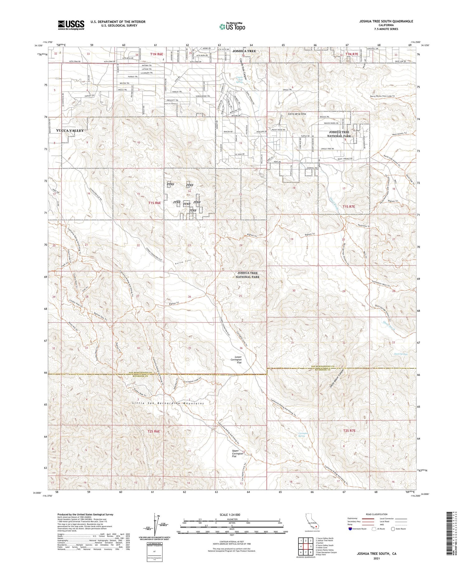
2021 topographic map quadrangle Joshua Tree South in the state of California. Scale: 1:24000. Based on the newly updated USGS 7.5' US Topo map series, this map is in the following counties: San Bernardino, Riverside. The map contains contour data, water features, and other items you are used to seeing on USGS maps, but also has updated roads and other features. This is the next generation of topographic maps. Printed on high-quality waterproof paper with UV fade-resistant inks.
Quads adjacent to this one:
West: Yucca Valley South
Northwest: Yucca Valley North
North: Joshua Tree North
Northeast: Sunfair
East: Indian Cove
Southeast: Keys View
South: East Deception Canyon
Southwest: Seven Palms Valley
This map covers the same area as the classic USGS quad with code o34116a3.
Contains the following named places: Cerro de la Silla, Covington Spring, Covington Well, Coyote Hole Spring, Friendly Hills Elementary School, Joshua Tree Census Designated Place, KROR-FM (Yucca Valley), La Contenta Junior High School, Lower Covington Flat, Nolina Cove, Quail Springs, Quail Wash, Smith Water Canyon, Upper Covington Flat, West Entrance Station