MyTopo
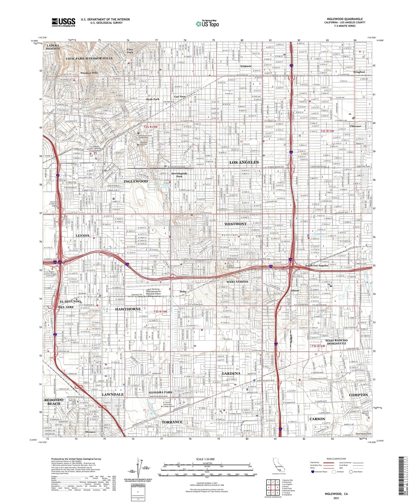
Inglewood California US Topo Map
Couldn't load pickup availability
2021 topographic map quadrangle Inglewood in the state of California. Scale: 1:24000. Based on the newly updated USGS 7.5' US Topo map series, this map is in the following counties: Los Angeles. The map contains contour data, water features, and other items you are used to seeing on USGS maps, but also has updated roads and other features. This is the next generation of topographic maps. Printed on high-quality waterproof paper with UV fade-resistant inks.
Quads adjacent to this one:
West: Venice
Northwest: Beverly Hills
North: Hollywood
Northeast: Los Angeles
East: South Gate
Southeast: Long Beach
South: Torrance
Southwest: Redondo Beach
This map covers the same area as the classic USGS quad with code o33118h3.
Contains the following named places: Aguaje de la Centinella, Algin Sutton Recreation Center, Alondra Golf Course, Alondra Park, Alondra Park Census Designated Place, Amestoy Elementary School, Angeles Mesa Elementary School, Anthony School, Anza School, Ascension School, Ashwood Park, Athens, Athens Park, Avalon Gardens, Avalon Gardens Elementary School, Avalon Municipal Hospital And Clinic, Avalon Villa Care Center, Baldwin Hills, Beach Boys Historic Landmark, Bell Park, Belle View Country Club, Belmar Convalescent Hospital, Bennett-Kew Elementary School, Bethune Park, Betsy Ross School, Bicentennial Park, Billy Mitchell Elementary School, Bodger Park, Bridgedale, Broadway Hospital, Brownfield Medical Building, Budlong Elementary School, Buford Elementary School, Burrel McDonald Park, Bursch Elementary School, Cabrillo School, California Military Academy, Campanella Park, Carr School, Carver Elementary School, Centennial High School, Center Park, Centinela Elementary School, Centinela Freeman Regional Medical Center, Centinela Park, Central Airport, Century Park Elementary School, Chapman Elementary School, Chester Washington Golf Course, Chesterfield Square, Childrens Baptist Home of Southern California, Christian School, Cimarron Avenue School, City of Gardena, City of Hawthorne, City of Inglewood, City of Lawndale, Claude Hudnall Elementary School, Clay Middle School, Convalescent Hospital, Crenshaw Imperial Plaza Shopping Center, Crenshaw Imperial Shopping Center, Cypave, Dale Page Park, Daniel Freeman Elementary School, Daniel Freeman Memorial Hospital, Darby Memorial Park, Davis School, Del Aire, Del Aire Census Designated Place, Del Aire Park, Delta, Denker Elementary School, Doctors Convalescent Hospital of Los Angeles, Dorset Village, Dunlap Sanitarium, Edison Middle School, Edison School, Eighty-Seventh Street School, El Camino Community College District, Electrical Sub-Station Number 41, Enterprise Middle School, Enterprise Park, Eucalyptus Elementary School, Faith Lutheran School, Felton Elementary School, Fifty-Fourth Street Elementary School, Fifty-Ninth Street Elementary School, Fifty-Second Street Elementary School, Figueroa Elementary School, Fortyeighth Street Park, Forty-Ninth Street Elementary School, Freeman Park, G W Carver Park, Gardena, Gardena Elementary School, Gardena Valley Airport, Gardena Valley Shopping Center, George W Crozier Middle School, Glen Anderson Park, Green Meadows Playground, Harte Preparatory Intermediate School, Harvard Playground, Hawthorne, Hawthorne High School, Hawthorne Intermediate School, Hawthorne Memorial Park, Hawthorne Plaza Shopping Center, Helen Keller Park, Hermosillo, Highland Elementary School, Hillcrest Medical Center, Holly Glen Park, Holly Park, Holly Park Plaza Shopping Center, Hollywood Park, Hooper Elementary School, Hyde Park, Hyde Park Convalescent Hospital, Hyde Park Elementary School, Imperial Hospital, Inglewood, Inglewood Country Club, Inglewood Division, Inglewood High School, Inglewood Junior Academy, Inglewood Park Cemetery, Jack Northrop Field/Hawthorne Municipal Airport, Jane Addams Elementary School, Jane Addams Park, Jefferson Elementary School, Jesse Owens County Park, Jim Thorpe Park, John C Fremont High School, Junipero Serra High School, Kellys Airport, Kew School, KJLH-FM (Compton), Ladera Heights Census Designated Place, Ladera Park, Ladera Shopping Center, Lawndale, Lennox, Lennox Census Designated Place, Lennox Park, Lincoln Memorial Park, Los Angeles Air Force Base, Los Angeles Division, Los Angeles Metropolitan Medical Center, Malloy Park, Manchester Manor Convalescent Hospital, Mausoleum of the Golden West, Memorial Hospital of Gardena, Moneta, Monteith Park, Morningside Hospital, Morningside Park, Morningside Park Reservoir, Mount Carmel Park, Mount Rainier Convalescent Hospital, Muir Middle School, Murdock Stadium, Norman O Houston Park, North Park, Oak Park Hospital, Pacific Square Shopping Center, Potrero Country Club, Queen Park, Ralph Bunche Elementary School, Recreation Park, Robert F Kennedy Medical Center, Rogers Park, Rogers-Anderson Park, Rose Hospital, Rosecrans Hills, Rosecrans Recreation Center, Rowley Memorial Park, Saint Andrews Recreation Center, Saint Erne Sanitarium, Sentinel Field, Siminski Park, Simmons Playground, South Hoover Hospital, South Los Angeles, South Park, Stanford M Anderson Water Treatment Plant, Strawberry Park, The Guardian Inglewood Convalescent Hospital, Theresa Lindsay Park, Thornburg Park, Tozai Shopping Center, Tragview Park, Transformer Station Number 18, Van Ness, Van Ness Playground, Vernon Hemingway Memorial Park, View Park, View Park-Windsor Hills Census Designated Place, Vista Hospital of South Bay, West Athens, West Athens Census Designated Place, West Florence Sub-Station, West Rancho Dominguez, West Rancho Dominguez Census Designated Place, Westmont, Westmont Census Designated Place, Wildasin, Will Rogers Memorial Park, William Anderson Elementary School, William Green Elementary School, William Green Park, William H Kelso Elementary School, Willowbrook, Willowbrook Park, Windsor Hills, Wingfoot, Worthington Elementary School, Zella Davis Park, ZIP Codes: 90003, 90043, 90044, 90047, 90056, 90061, 90247, 90248, 90249, 90250, 90260, 90301, 90302, 90303, 90304, 90305, 90506


