MyTopo
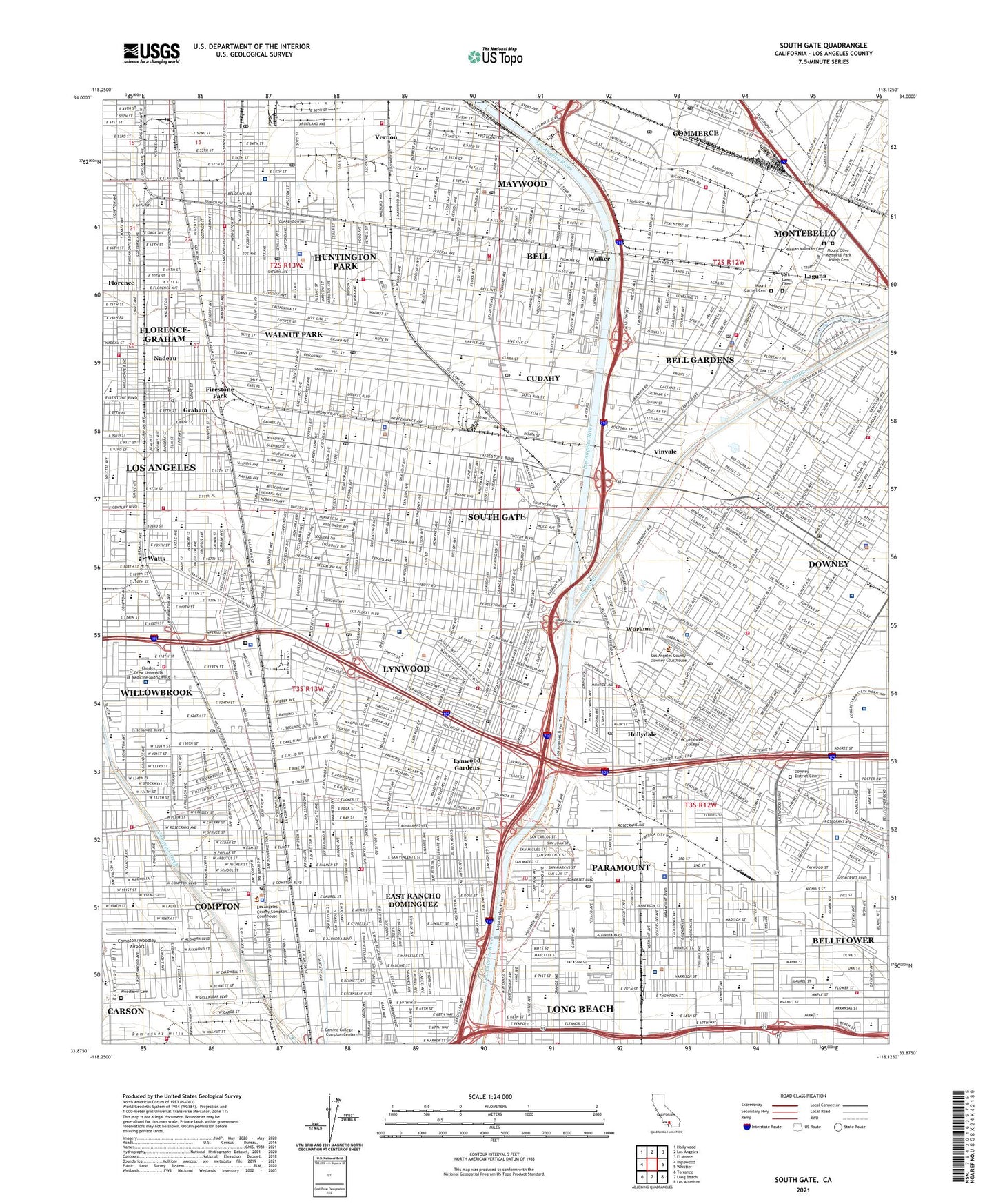
South Gate California US Topo Map
Couldn't load pickup availability
2021 topographic map quadrangle South Gate in the state of California. Scale: 1:24000. Based on the newly updated USGS 7.5' US Topo map series, this map is in the following counties: Los Angeles. The map contains contour data, water features, and other items you are used to seeing on USGS maps, but also has updated roads and other features. This is the next generation of topographic maps. Printed on high-quality waterproof paper with UV fade-resistant inks.
Quads adjacent to this one:
West: Inglewood
Northwest: Hollywood
North: Los Angeles
Northeast: El Monte
East: Whittier
Southeast: Los Alamitos
South: Long Beach
Southwest: Torrance
This map covers the same area as the classic USGS quad with code o33118h2.
Contains the following named places: Alameda Elementary School, Alondra Crest Hospital, Alondra Intermediate School, Anderson Elementary School, Apollo Park, Baptist Day School, Bell, Bell Gardens, Bell Gardens Elementary School, Bell Gardens High School, Bell Gardens Intermediate School, Bell Gardens Marketplace Shopping Center, Bell Gardens Park, Bell Medical Center, Bell Palm Plaza Shopping Center, Bell Senior High School, Bell Shopping Center, Bellflower Adult Education Center, Bellflower Golf Center, Bellflower Plaza Shopping Center, Bellflower Towne Center Shopping Center, Blair School, Brethren Day School, Brethren High School, Brookshire Childrens Park, Bryson Elementary School, Bunche Middle School, Camp Suanga, Carnation Park, Carpenter Elementary School, Century Plaza Shopping Center, Cheli Air Force Station, City of Bell, City of Bell Gardens, City of Bellflower, City of Commerce, City of Compton, City of Cudahy, City of Downey, City of Huntington Park, City of Lynwood, City of Maywood, City of Paramount, City of South Gate, Clara Park, Clearwater, Clearwater Station, Colmar Elementary School, Colonel Leo H Washington Park, Commerce Business Park Heliport, Community and Mission Hospital of Huntington Park Florence, Community Hospital of Huntington Park, Compton, Compton Avenue Elementary School, Compton Community College, Compton High School, Compton Par Three Golf Course, Compton Sanitarium, Compton Towne Center Shopping Center, Compton/Woodley Airport, Corona Elementary School, Corona Park, Crawford Park, Cudahy, Cudahy Park, Cudahy Station, Cudahy Sub-Station, Darwell Park, Del Rio Sanitarium, Doctor Walter R Tucker Park, Dominguez High School, Downey, Downey District Cemetery, Downey High School, Downs Playground, Drew Middle School, East Rancho Dominguez, East Rancho Dominguez Census Designated Place, East Rancho Dominguez County Park, El Rancho Mobile Home Park, Elizabeth Learning Center, Ellerman Park, Emerson Elementary School, Firestone Park, Fishburn Elementary School, Florence, Florence Avenue School, Florence-Graham Census Designated Place, Ford Park Golf Course, Foster Elementary School, Fountain Garden Convalescent Hospital, Fred W Hosler Junior High School, Furman Park, Gage, Gage Middle School, Gallant Park, Garfield School, Golden Park, Gonzales Park, Good Shepherd Convalescent Hospital, Graham, Graham Elementary School, Grape Street Elementary School, Grove School, Hacienda Village, Hamilton Junior High School, Heliotrope Elementary School, Hollydale, Hollydale Elementary School, Hollydale Park, Holmes Elementary School, Huntington Park, Imperial Courts, Imperial Elementary School, Janie P Abbott Elementary School, Jefferson Elementary School, John A Ford Park, John S Simms Park, Jordan Downs, Jordan High School, Kaiser Permanente Hospital Belflower, Kelly Elementary School, Kelly Park, Kenneth Hahn Plaza Shopping Center, KGER-AM (Long Beach), King-Harbor Hospital, Laguna, Lentz Field, Lighthipe Substation, Little Bear Park, Los Amigos Golf Course, Los Angeles Eastside Airport, Los Padrinos Juvenile Hall, Lugo Park, Lynwood, Lynwood Gardens, Lynwood Park, Lynwood Station, Marlow Park, Maywood, Maywood Park, Maywood Village Square Shopping Center, Middleton Street Recreation Center, Miles Park, Mona Park, Morton, Mount Carmel Cemetery, Mount Olive Memorial Park Jewish Cemetery, Municipal Golf Course, Nadeau, Nickerson Gardens, Nimitz Middle School, Oak Avenue Playground, One Hundred Ninth Street Recreation Center, Pacific Center Shopping Center, Paramount, Paramount Park, Park Lawn Cemetery, Pequino Park, PIH Health Downey Hospital, Pixley Park, Pritchard Field, Progress Park, Pueblo Del Rio Public Housing, R I Sd Downey Helistop, Rancho Los Amigos Medical Center, Rancho Los Amigos National Rehabilitation Center, Raymond Street Park, Rendalia, Rio Hondo, Rio Hondo Country Club, Ronald E McNair Elementary School, Roosevelt Middle School, Roosevelt Park, Rose Park, Russian Molokan Cemetery, Saint Francis Medical Center, Saint Francis Medical Center Helistop, Salt Lake Park, San Antonio, Sibrie Park, Simons, Slauson Playground, South Central Multipurpose Health Service Center, South Gate, South Gate Park, South Gate Plaza Shopping Center, South Gate Towne Center Shopping Center, South Gate-East Los Angeles Division, South Park, South-East Doctors Hospital, Spane Park, Stanford Avenue Park, Steam Engine Park, Suburban Hospital, Suburban Medical Center of Promise Hospital, Tajauta, Thompson Park, Treasure Island Park, Treder Park, Tweedy Marketplace Shopping Center, Veterans Memorial Park, Veterans Park, Village Park, Vinvale, Walker, Walnut Park, Walnut Park Census Designated Place, Watts, Watts Senior Center, Watts Tower, Watts Towers of Simon Rodia State Historic Park, Wesley Gaines Elementary School, Westside Park, Willow Brook, Willowbrook Census Designated Place, Wilson Park, Woodlawn Cemetery, Workman, ZIP Codes: 90001, 90002, 90040, 90059, 90201, 90220, 90221, 90222, 90241, 90242, 90255, 90262, 90270, 90280, 90706, 90723


