MyTopo
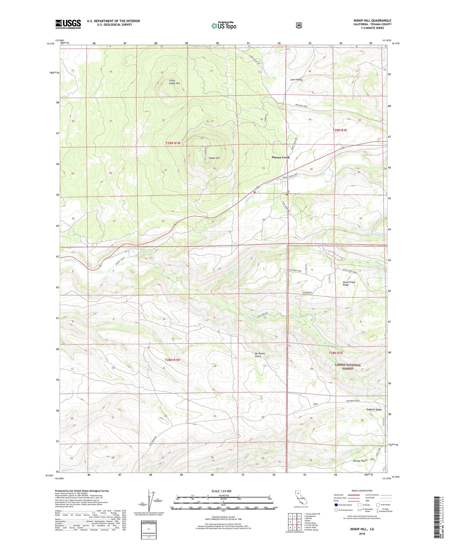
Inskip Hill California US Topo Map
Couldn't load pickup availability
Also explore the Inskip Hill Forest Service Topo of this same quad for updated USFS data
2022 topographic map quadrangle Inskip Hill in the state of California. Scale: 1:24000. Based on the newly updated USGS 7.5' US Topo map series, this map is in the following counties: Tehama. The map contains contour data, water features, and other items you are used to seeing on USGS maps, but also has updated roads and other features. This is the next generation of topographic maps. Printed on high-quality waterproof paper with UV fade-resistant inks.
Quads adjacent to this one:
West: Dales
Northwest: Tuscan Buttes NE
North: Shingletown
Northeast: Manton
East: Finley Butte
Southeast: Panther Spring
South: Dewitt Peak
Southwest: Tuscan Springs
This map covers the same area as the classic USGS quad with code o40121c8.
Contains the following named places: Childs Ranch, Hogback Ridge, Inskip Hill, Lane Valley, Lane Valley School, Little Inskip Hill, McKenzie Place, Meyers Place, Mount Lassen Trout Farm, North Fork Plum Creek, Oat Creek, Paynes Creek, Paynes Creek Census Designated Place, Plum Creek, Plum Valley Elementary School, Shults Ranch, Tehama County Fire Department Paynes Creek, Tehama County Fire Department Station 21 Paynes Creek, Wade Place