MyTopo
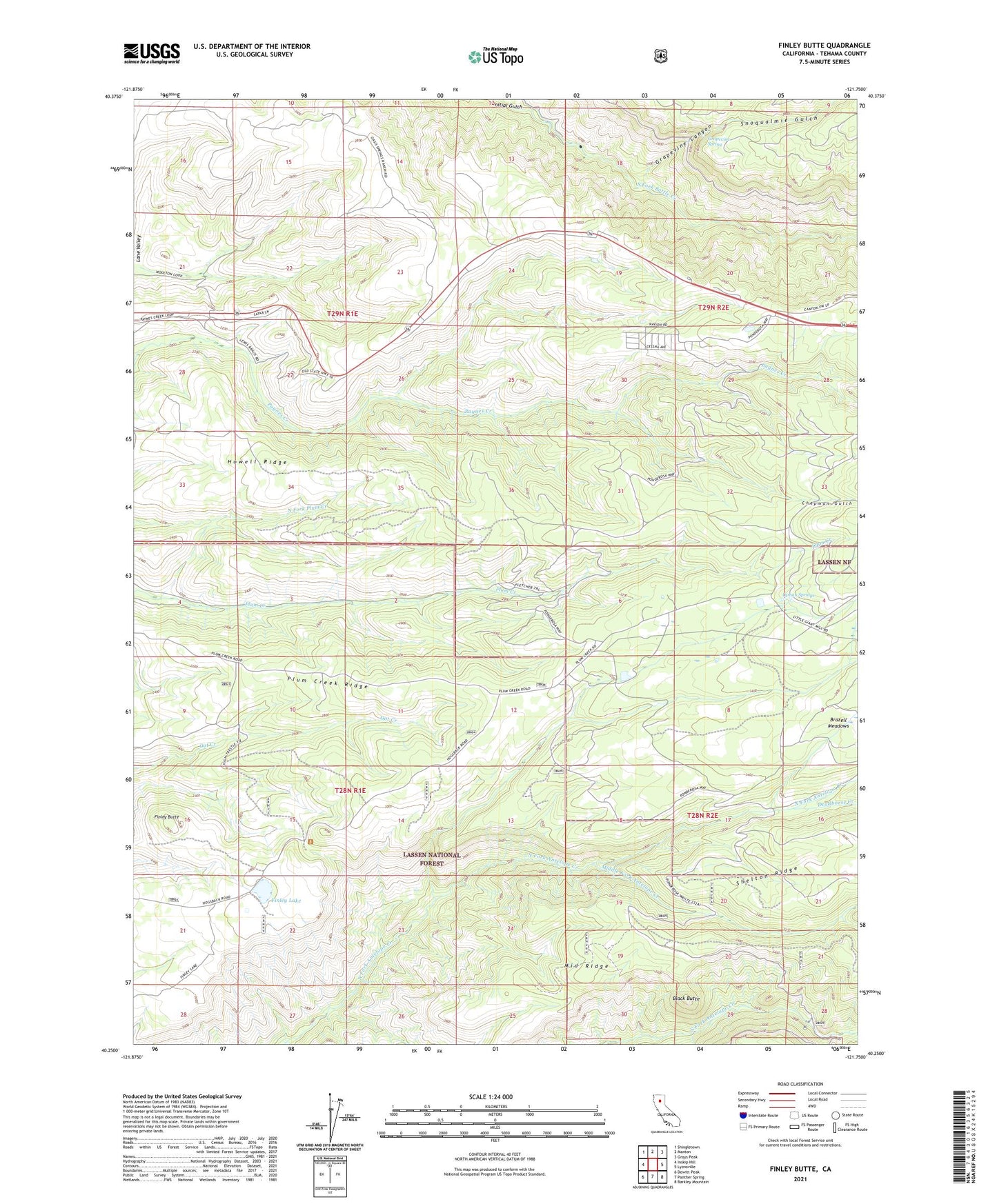
Finley Butte California US Topo Map
Couldn't load pickup availability
Also explore the Finley Butte Forest Service Topo of this same quad for updated USFS data
2021 topographic map quadrangle Finley Butte in the state of California. Scale: 1:24000. Based on the newly updated USGS 7.5' US Topo map series, this map is in the following counties: Tehama. The map contains contour data, water features, and other items you are used to seeing on USGS maps, but also has updated roads and other features. This is the next generation of topographic maps. Printed on high-quality waterproof paper with UV fade-resistant inks.
Quads adjacent to this one:
West: Inskip Hill
Northwest: Shingletown
North: Manton
Northeast: Grays Peak
East: Lyonsville
Southeast: Barkley Mountain
South: Panther Spring
Southwest: Dewitt Peak
This map covers the same area as the classic USGS quad with code o40121c7.
Contains the following named places: Black Butte, Chapman Gulch, Dantuma Place, Deadhorse Creek, Finley Butte, Finley Lake, Finley Place, Grapevine Canyon, Grapevine Spring, High Trestle, Hillhouse, Howell Ridge, Initial Gulch, Judd Creek, Lyman Springs, Marian Place, McClure Place, Middle Fork Antelope Creek, Middle Ridge, Paynes Creek Rod and Gun Club, Plum Creek Ridge, Ponderosa Sky Ranch, Ponderosa Sky Ranch Airport, Shake House, Snoqualmie Gulch, South Antelope Campground, Wilson Ranch, ZIP Code: 96075