MyTopo
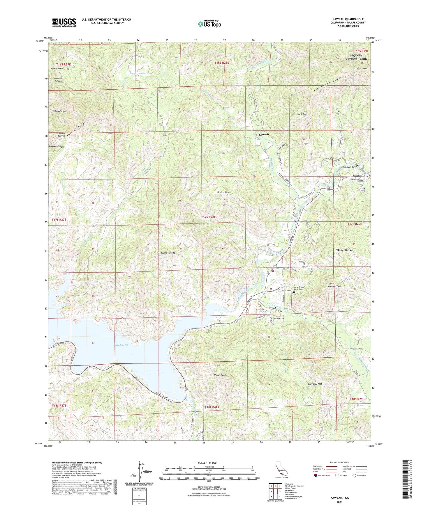
Kaweah California US Topo Map
Couldn't load pickup availability
2021 topographic map quadrangle Kaweah in the state of California. Scale: 1:24000. Based on the newly updated USGS 7.5' US Topo map series, this map is in the following counties: Tulare. The map contains contour data, water features, and other items you are used to seeing on USGS maps, but also has updated roads and other features. This is the next generation of topographic maps. Printed on high-quality waterproof paper with UV fade-resistant inks.
Quads adjacent to this one:
West: Woodlake
Northwest: Auckland
North: Shadequarter Mountain
Northeast: Giant Forest
East: Case Mountain
Southeast: Dennison Peak
South: Chickencoop Canyon
Southwest: Rocky Hill
This map covers the same area as the classic USGS quad with code o36118d8.
Contains the following named places: Barton Mountain, Blossom Peak, Cherokee Flat, Comb Rocks, Department of Forestry and Fire Protection Three Rivers Unit, Greasy Creek, Horse Creek, Horse Creek Recreation Area, Kaweah, Kaweah Recreation Area, Lake Kaweah, Lake Kaweah Boat Patrol, Lake Kaweah Recreation Area, Lemon Hill, Mankins Creek, Mankins Flat, North Fork Kaweah River, Shepherd Peak, South Fork Kaweah River, Sulphur Ridge, Tharps Peak, Three Rivers, Three Rivers Ambulance, Three Rivers Census Designated Place, Three Rivers Elementary School, Three Rivers Golf Course, Three Rivers Post Office, Three Rivers Public Cemetery, Tulare County Fire Department Battalion 1 Three Rivers Station 14, Union School, Washburn Cove, ZIP Code: 93244