MyTopo
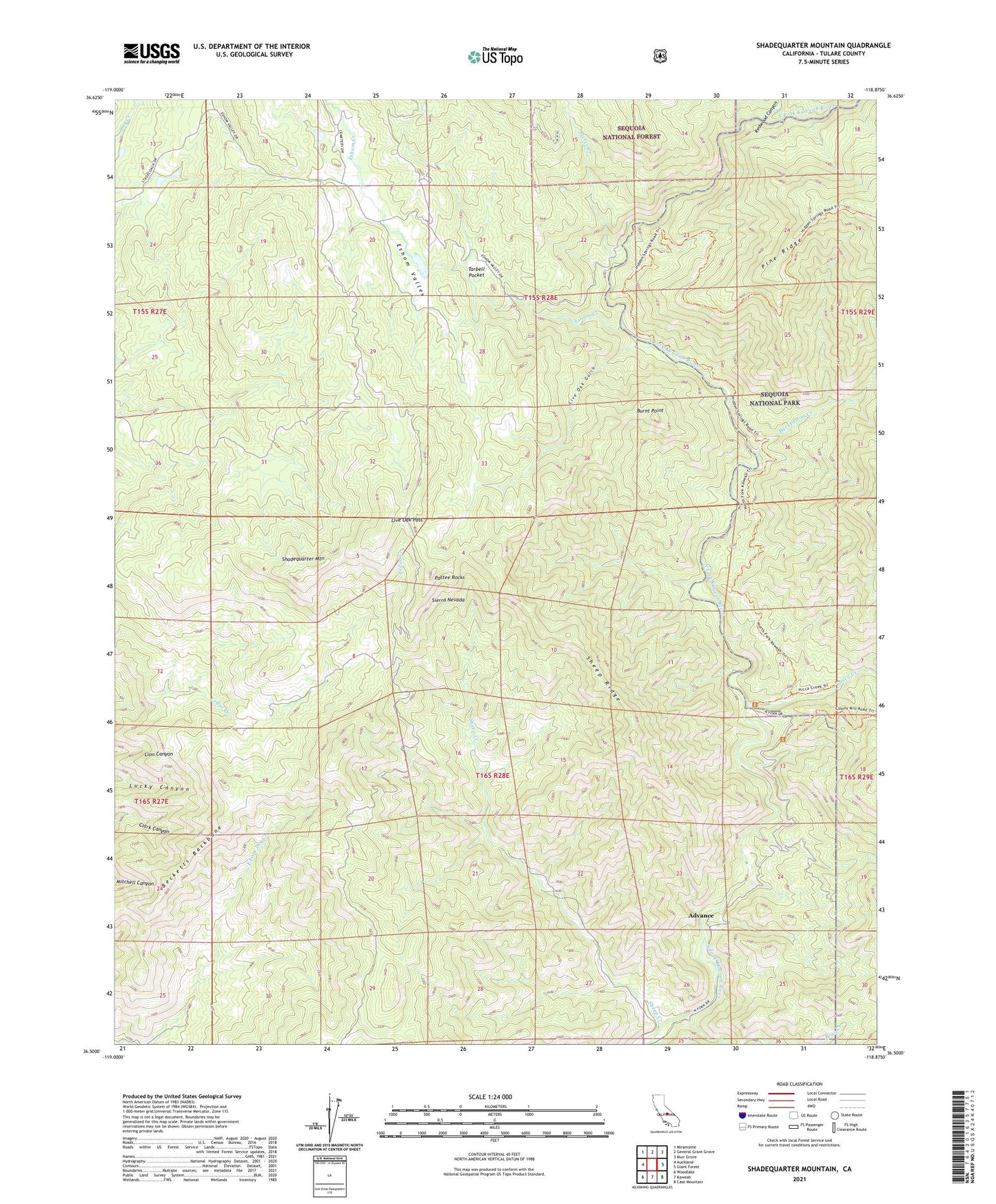
Shadequarter Mountain California US Topo Map
Couldn't load pickup availability
Also explore the Shadequarter Mountain Forest Service Topo of this same quad for updated USFS data
2021 topographic map quadrangle Shadequarter Mountain in the state of California. Scale: 1:24000. Based on the newly updated USGS 7.5' US Topo map series, this map is in the following counties: Tulare. The map contains contour data, water features, and other items you are used to seeing on USGS maps, but also has updated roads and other features. This is the next generation of topographic maps. Printed on high-quality waterproof paper with UV fade-resistant inks.
Quads adjacent to this one:
West: Auckland
Northwest: Miramonte
North: General Grant Grove
Northeast: Muir Grove
East: Giant Forest
Southeast: Case Mountain
South: Kaweah
Southwest: Woodlake
This map covers the same area as the classic USGS quad with code o36118e8.
Contains the following named places: Advance, Bear Creek, Becketts Backbone, Burnt Point, Burnt Point Creek, Eshom Creek, Eshom Valley, Live Oak Gulch, Live Oak Pass, Pattee Rocks, Pierce Creek, Redwood Canyon, Redwood Creek, Shadequarter Lookout, Shadequarter Mountain, Sheep Creek, Sheep Ridge, Tarbell Pocket, Yucca Creek, ZIP Code: 93603