MyTopo
Case Mountain California US Topo Map
Couldn't load pickup availability
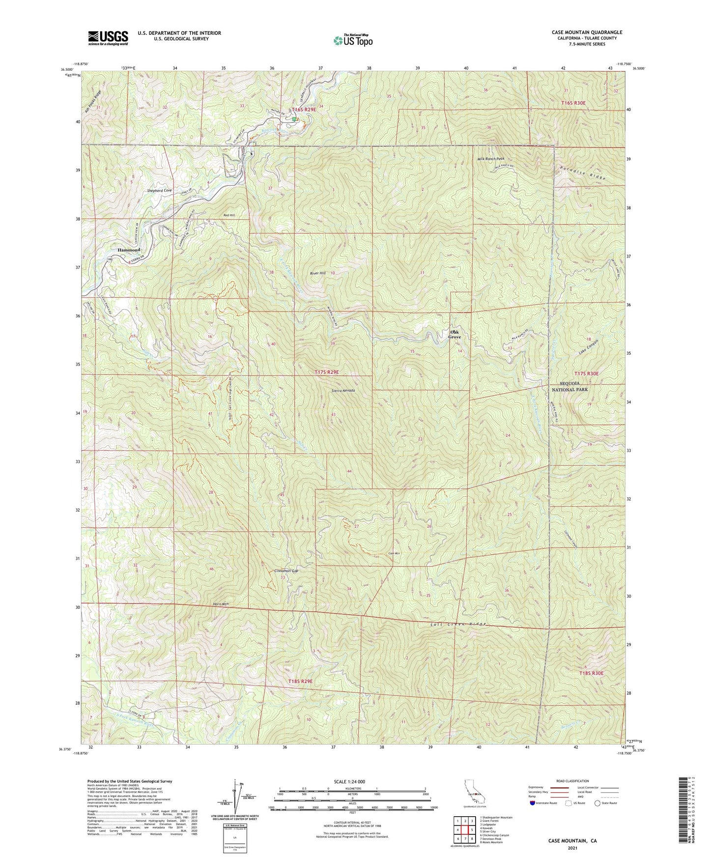
2021 topographic map quadrangle Case Mountain in the state of California. Scale: 1:24000. Based on the newly updated USGS 7.5' US Topo map series, this map is in the following counties: Tulare. The map contains contour data, water features, and other items you are used to seeing on USGS maps, but also has updated roads and other features. This is the next generation of topographic maps. Printed on high-quality waterproof paper with UV fade-resistant inks.
Quads adjacent to this one:
West: Kaweah
Northwest: Shadequarter Mountain
North: Giant Forest
Northeast: Lodgepole
East: Silver City
Southeast: Moses Mountain
South: Dennison Peak
Southwest: Chickencoop Canyon
This map covers the same area as the classic USGS quad with code o36118d7.
Contains the following named places: Ash Mountain Heliport, Ash Mountain National Park Headquarters, Case Mountain, Case Mountain Grove, Cinnamon Gap, Coffeepot Canyon, East Fork Kaweah River, Grunigen Creek, Hammond, Horn Mountain, Lake Canyon, Lookout Point Ranger Station, Milk Ranch Lookout, Milk Ranch Peak, Oak Grove, Red Hill, River Hill, Salt Creek, Sequoia District Ranger Station, Shepherd Cove, Squirrel Creek, ZIP Code: 93271