MyTopo
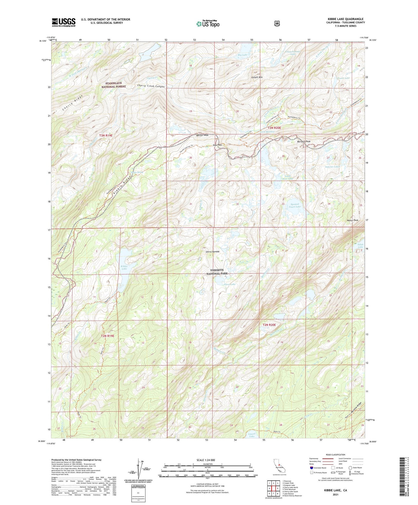
Kibbie Lake California US Topo Map
Couldn't load pickup availability
Also explore the Kibbie Lake Forest Service Topo of this same quad for updated USFS data
2021 topographic map quadrangle Kibbie Lake in the state of California. Scale: 1:24000. Based on the newly updated USGS 7.5' US Topo map series, this map is in the following counties: Tuolumne. The map contains contour data, water features, and other items you are used to seeing on USGS maps, but also has updated roads and other features. This is the next generation of topographic maps. Printed on high-quality waterproof paper with UV fade-resistant inks.
Quads adjacent to this one:
West: Cherry Lake North
Northwest: Pinecrest
North: Cooper Peak
Northeast: Emigrant Lake
East: Tiltill Mountain
Southeast: Hetch Hetchy Reservoir
South: Lake Eleanor
Southwest: Cherry Lake South
This map covers the same area as the classic USGS quad with code o38119a7.
Contains the following named places: Bartlett Creek, Bartlett Peak, Big Lake, Boundary Lake, Cherry Ridge, East Fork Cherry Creek, Flora Lake, Gillett Mountain, Hyatt Lake, Inferno Lakes, Kendrick Creek, Kibbie Lake, Kibbie Ridge, Little Bear Lake, Lord Meadow, Many Island Lake, Mercur Peak, Nance Peak, North Fork Cherry Creek, Pruett Lake, Sachse Spring, Spotted Fawn Lake, Stanislaus-Yosemite Division, Styx Pass, Twain Harte-Tuolumne City Division, Yellowhammer Lake