MyTopo
Emigrant Lake California US Topo Map
Couldn't load pickup availability
Also explore the Emigrant Lake Forest Service Topo of this same quad for updated USFS data
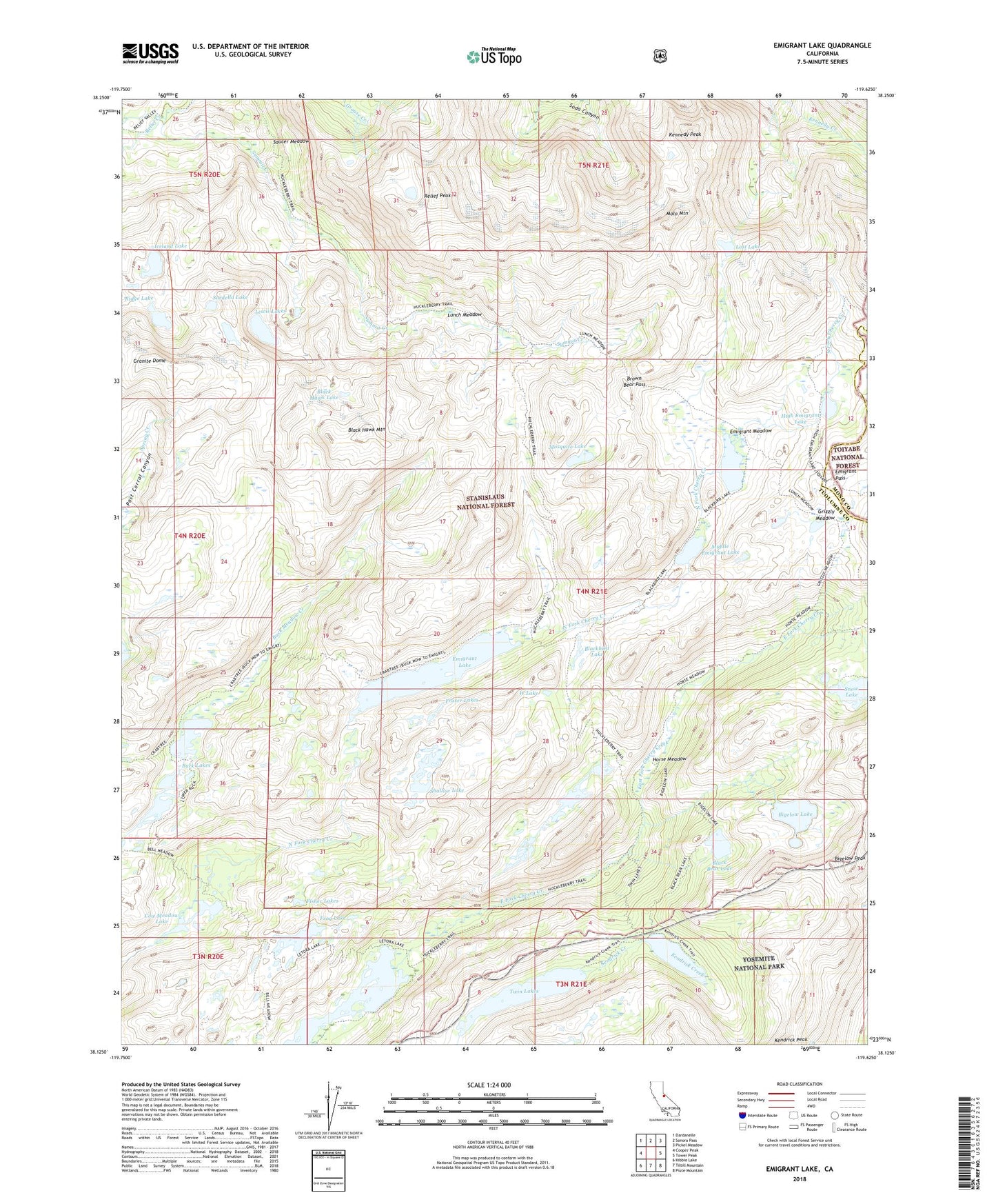
2024 topographic map quadrangle Emigrant Lake in the state of California. Scale: 1:24000. Based on the newly updated USGS 7.5' US Topo map series, this map is in the following counties: Tuolumne, Mono. The map contains contour data, water features, and other items you are used to seeing on USGS maps, but also has updated roads and other features. This is the next generation of topographic maps. Printed on high-quality waterproof paper with UV fade-resistant inks.
Quads adjacent to this one:
West: Cooper Peak
Northwest: Dardanelle
North: Sonora Pass
Northeast: Pickel Meadow
East: Tower Peak
Southeast: Piute Mountain
South: Tiltill Mountain
Southwest: Kibbie Lake
This map covers the same area as the classic USGS quad with code o38119b6.
Contains the following named places: Bigelow Lake, Bigelow Lake 1-026 Dam, Bigelow Peak, Black Bear Lake, Black Hawk Lake, Black Hawk Mountain, Blackbird Lake, Brown Bear Pass, Buck Lake, Buck Lake Dam, Buck Lakes, Cow Meadow Lake, Emigrant Lake, Emigrant Lake Dam, Emigrant Meadow, Emigrant Meadow Lake, Emigrant Pass, Fisher Lakes, Fraser Lakes, Frog Lake, Granite Dome, Grizzly Meadow, High Emigrant Lake, High Emigrant Lake 1-027 Dam, Horse Meadow, Horse Meadow Reservoir, Huckleberry Lake, Iceland Lake, Kennedy Peak, Lertora Lake, Lewis Lakes, Long Lake Dam, Lost Lake, Lower Buck Lake 1-025 Dam, Lunch Meadow, Maxwell Lake, Middle Emigrant Dam, Middle Emigrant Lake, Molo Mountain, Mosquito Lake, Relief Creek, Relief Peak, Ridge Lake, Sachse Monument, Sardella Lake, Saucer Meadow, Shallow Lake, Sheep Camp, Snow Lake, Snowlake Dam, Snowlake Reservoir, Twin Lakes, W Lake