MyTopo
Hetch Hetchy Reservoir California US Topo Map
Couldn't load pickup availability
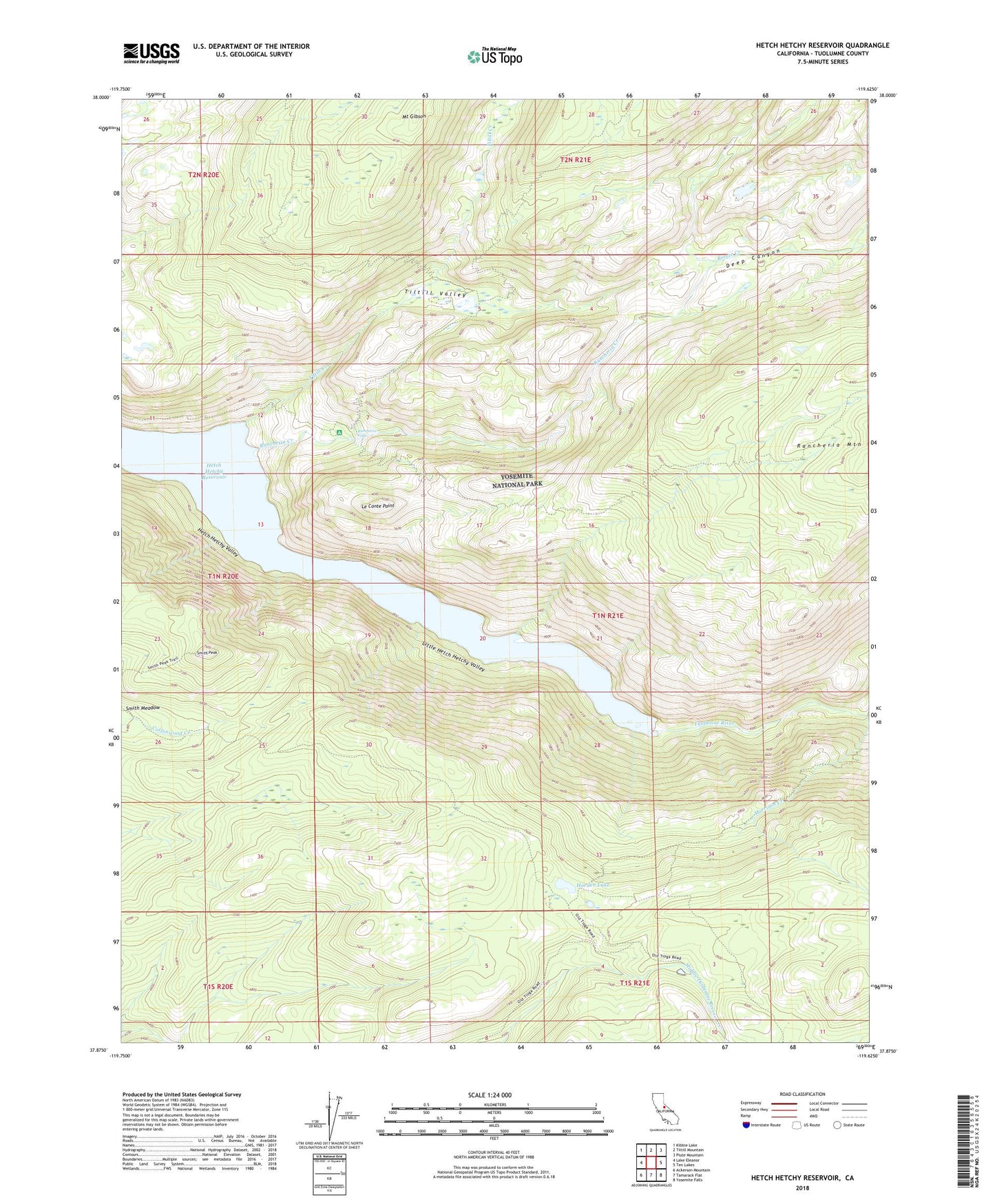
2021 topographic map quadrangle Hetch Hetchy Reservoir in the state of California. Scale: 1:24000. Based on the newly updated USGS 7.5' US Topo map series, this map is in the following counties: Tuolumne. The map contains contour data, water features, and other items you are used to seeing on USGS maps, but also has updated roads and other features. This is the next generation of topographic maps. Printed on high-quality waterproof paper with UV fade-resistant inks.
Quads adjacent to this one:
West: Lake Eleanor
Northwest: Kibbie Lake
North: Tiltill Mountain
Northeast: Piute Mountain
East: Ten Lakes
Southeast: Yosemite Falls
South: Tamarack Flat
Southwest: Ackerson Mountain
This map covers the same area as the classic USGS quad with code o37119h6.
Contains the following named places: Breeze Creek, Deep Canyon, Harden Gardens, Harden Lake, Hetch Hetchy Reservoir, Le Conte Point, Little Hetch Hetchy Valley, Morrison Creek, Mount Gibson, Rancheria Creek, Rancheria Falls, Smith Peak, Tiltill Creek, Tiltill Valley