MyTopo
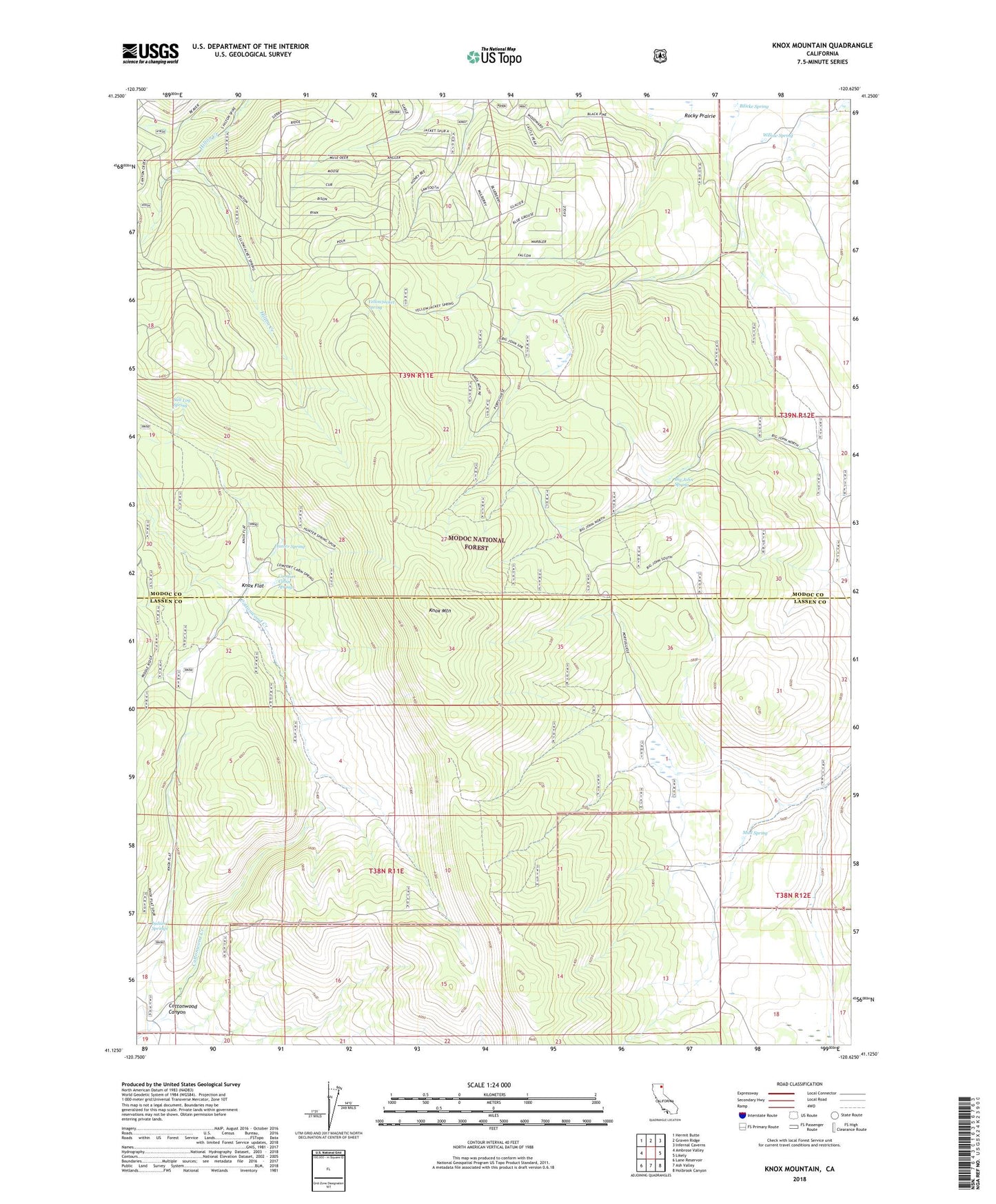
Knox Mountain California US Topo Map
Couldn't load pickup availability
Also explore the Knox Mountain Forest Service Topo of this same quad for updated USFS data
2021 topographic map quadrangle Knox Mountain in the state of California. Scale: 1:24000. Based on the newly updated USGS 7.5' US Topo map series, this map is in the following counties: Modoc, Lassen. The map contains contour data, water features, and other items you are used to seeing on USGS maps, but also has updated roads and other features. This is the next generation of topographic maps. Printed on high-quality waterproof paper with UV fade-resistant inks.
Quads adjacent to this one:
West: Ambrose Valley
Northwest: Hermit Butte
North: Graven Ridge
Northeast: Infernal Caverns
East: Likely
Southeast: Holbrook Canyon
South: Ash Valley
Southwest: Lane Reservoir
This map covers the same area as the classic USGS quad with code o41120b6.
Contains the following named places: Big John Spring, Bilicke Spring, Comfort Cabin Springs, Cottonwood Canyon, Hilton, Hunter Spring, Indian Springs, Knox Flat, Knox Mountain, Mud Spring, Old Likely Mill, Portuguese Sheep Camp, Salt Log Spring, Willow Spring, Yellowjacket Spring