MyTopo
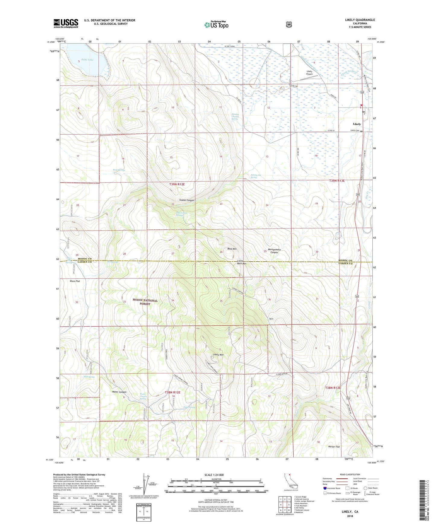
Likely California US Topo Map
Couldn't load pickup availability
Also explore the Likely Forest Service Topo of this same quad for updated USFS data
2021 topographic map quadrangle Likely in the state of California. Scale: 1:24000. Based on the newly updated USGS 7.5' US Topo map series, this map is in the following counties: Modoc, Lassen. The map contains contour data, water features, and other items you are used to seeing on USGS maps, but also has updated roads and other features. This is the next generation of topographic maps. Printed on high-quality waterproof paper with UV fade-resistant inks.
Quads adjacent to this one:
West: Knox Mountain
Northwest: Graven Ridge
North: Infernal Caverns
Northeast: Little Juniper Reservoir
East: Tule Mountain
Southeast: Madeline
South: Holbrook Canyon
Southwest: Ash Valley
This map covers the same area as the classic USGS quad with code o41120b5.
Contains the following named places: Bald Mountain, BLM Fireguard Station, Box Springs, Cottonwood Springs, D Flourney, Dago Spring, Delta Lake, Dry Creek, Johnny Ois Spring, K Flourney, Likely, Likely Airport, Likely Cemetery, Likely Census Designated Place, Likely Mountain, Likely Post Office, Likely Volunteer Fire Protection District, Little Bald Mountain, Montgomery Canyon, Mud Spring, R Flourney, Rock Springs, Sears Flat, Sears Flat Spring, Smokey Charley Spring, South Fork Elementary School, Stones Canyon, Vestil, Water Canyon, Water Canyon Spring